
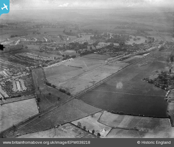
EPW038218 ENGLAND (1932). The Dartford Loop Railway Link and construction of new housing around Old Farm Avenue and environs, Sidcup, from the west, 1932
© Hawlfraint cyfranwyr OpenStreetMap a thrwyddedwyd gan yr OpenStreetMap Foundation. 2026. Trwyddedir y gartograffeg fel CC BY-SA.
Delweddau cyfagos (5)
EPW038218

EPW038216

EPW038220

EPW035579

EPW044390

Manylion
| Pennawd | [EPW038218] The Dartford Loop Railway Link and construction of new housing around Old Farm Avenue and environs, Sidcup, from the west, 1932 |
| Cyfeirnod | EPW038218 |
| Dyddiad | June-1932 |
| Dolen | |
| Enw lle | SIDCUP |
| Plwyf | |
| Ardal | |
| Gwlad | ENGLAND |
| Dwyreiniad / Gogleddiad | 544800, 172800 |
| Hydred / Lledred | 0.083420448904052, 51.435178105908 |
| Cyfeirnod Grid Cenedlaethol | TQ448728 |
Pinnau
Byddwch y cyntaf i ychwanegu sylw at y ddelwedd hon!