
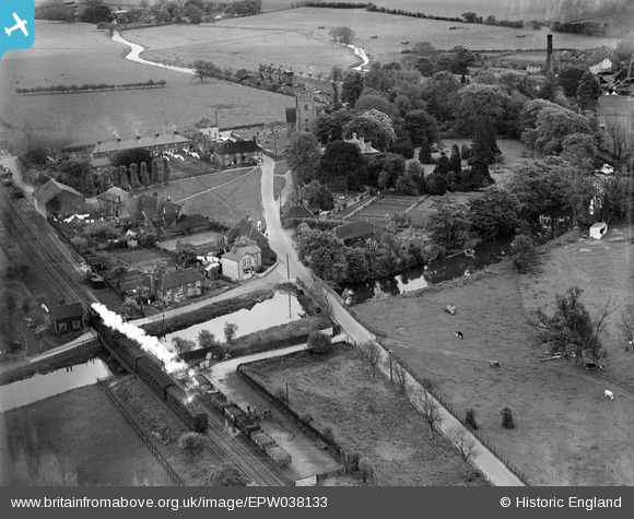
EPW038133 ENGLAND (1932). The road and railway bridges over the Great Stour, Chartham, 1932
© Hawlfraint cyfranwyr OpenStreetMap a thrwyddedwyd gan yr OpenStreetMap Foundation. 2026. Trwyddedir y gartograffeg fel CC BY-SA.
Delweddau cyfagos (4)
EPW038133

EAW004716

EAW004717

EAW004718

Manylion
| Pennawd | [EPW038133] The road and railway bridges over the Great Stour, Chartham, 1932 |
| Cyfeirnod | EPW038133 |
| Dyddiad | May-1932 |
| Dolen | |
| Enw lle | CHARTHAM |
| Plwyf | CHARTHAM |
| Ardal | |
| Gwlad | ENGLAND |
| Dwyreiniad / Gogleddiad | 610484, 155086 |
| Hydred / Lledred | 1.0168338919967, 51.255513167494 |
| Cyfeirnod Grid Cenedlaethol | TR105551 |
Pinnau
Byddwch y cyntaf i ychwanegu sylw at y ddelwedd hon!