
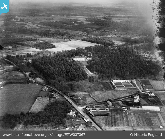
EPW037367 ENGLAND (1932). Bransgore House, Bransgore, from the south-west, 1932. This image has been produced from a damaged negative.
© Hawlfraint cyfranwyr OpenStreetMap a thrwyddedwyd gan yr OpenStreetMap Foundation. 2026. Trwyddedir y gartograffeg fel CC BY-SA.
Delweddau cyfagos (9)
EPW037367

EPW037372

EPW037375

EPW037371

EPW037368

EPW037376

EPW037370

EPW037373

EPW037369

Manylion
| Pennawd | [EPW037367] Bransgore House, Bransgore, from the south-west, 1932. This image has been produced from a damaged negative. |
| Cyfeirnod | EPW037367 |
| Dyddiad | 12-April-1932 |
| Dolen | |
| Enw lle | BRANSGORE |
| Plwyf | BRANSGORE |
| Ardal | |
| Gwlad | ENGLAND |
| Dwyreiniad / Gogleddiad | 419090, 98092 |
| Hydred / Lledred | -1.7291884077821, 50.781522263618 |
| Cyfeirnod Grid Cenedlaethol | SZ191981 |
Pinnau
Cyfraniadau Grŵp
Thanks for the help with this image and the others in the group of the site. I shall post the same message to all of them (just to be clear that we have picked up on the information). We'll update the catalogue record, and post the updated details here in due course. Yours, Katy Britain from Above Cataloguing Team Leader |
Katy Whitaker |
Friday 8th of March 2013 03:08:08 PM |
Bransgore House as identified by RichardW |

Class31 |
Thursday 3rd of January 2013 05:01:59 PM |
see also EPW037368,9,70,71,2,3,4,5 & 6. |

BigglesH |
Sunday 16th of December 2012 04:42:38 PM |