
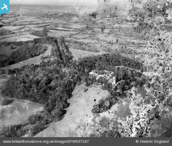
EPW037187 ENGLAND (1931). Wadhurst Hall and environs, Wadhurst Park, from the south, 1931. This image has been produced from a damaged negative.
© Hawlfraint cyfranwyr OpenStreetMap a thrwyddedwyd gan yr OpenStreetMap Foundation. 2026. Trwyddedir y gartograffeg fel CC BY-SA.
Delweddau cyfagos (10)
EPW037187

EPW037201

EPW037205

EPW037203

EPW037204

EPW037202

EPW037176

EPW037172

EPW037178

EPW037177

Manylion
| Pennawd | [EPW037187] Wadhurst Hall and environs, Wadhurst Park, from the south, 1931. This image has been produced from a damaged negative. |
| Cyfeirnod | EPW037187 |
| Dyddiad | November-1931 |
| Dolen | |
| Enw lle | WADHURST PARK |
| Plwyf | WADHURST |
| Ardal | |
| Gwlad | ENGLAND |
| Dwyreiniad / Gogleddiad | 563176, 128714 |
| Hydred / Lledred | 0.32751184997009, 51.034051706528 |
| Cyfeirnod Grid Cenedlaethol | TQ632287 |
Pinnau
Byddwch y cyntaf i ychwanegu sylw at y ddelwedd hon!