
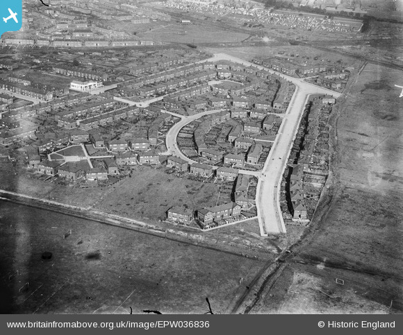
EPW036836 ENGLAND (1931). Housing estate adjacent to Melland Playing Field, Gorton, 1931
© Hawlfraint cyfranwyr OpenStreetMap a thrwyddedwyd gan yr OpenStreetMap Foundation. 2026. Trwyddedir y gartograffeg fel CC BY-SA.
Delweddau cyfagos (10)
EPW036836

EPW036827

EPW035591

EPW035595

EPW035592

EPW035594

EPW036828

EPW036837

EPW036832

EPW036833

Manylion
| Pennawd | [EPW036836] Housing estate adjacent to Melland Playing Field, Gorton, 1931 |
| Cyfeirnod | EPW036836 |
| Dyddiad | September-1931 |
| Dolen | |
| Enw lle | GORTON |
| Plwyf | |
| Ardal | |
| Gwlad | ENGLAND |
| Dwyreiniad / Gogleddiad | 388638, 395081 |
| Hydred / Lledred | -2.1711123803099, 53.452110094732 |
| Cyfeirnod Grid Cenedlaethol | SJ886951 |
Pinnau
Byddwch y cyntaf i ychwanegu sylw at y ddelwedd hon!
Cyfraniadau Grŵp
Taken in 1931, this image shows a different kind of home - the dawn of the Council House Estate. Wide, crescent-shaped roads (people walking, no cars)new shopping units and for the first time many people had their own gardens. It was a huge improvement on the back-to-back houses in the heavily industrialised areas. We believe that the playing fields are still well used...but did they ever complete that road? |

BFA Crowcroft Tatton Project |
Friday 4th of July 2014 11:17:54 AM |