
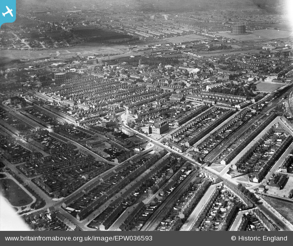
EPW036593 ENGLAND (1931). The town centre, Barking, from the south-east, 1931
© Hawlfraint cyfranwyr OpenStreetMap a thrwyddedwyd gan yr OpenStreetMap Foundation. 2026. Trwyddedir y gartograffeg fel CC BY-SA.
Delweddau cyfagos (2)
EPW036593

EPW036595

Manylion
| Pennawd | [EPW036593] The town centre, Barking, from the south-east, 1931 |
| Cyfeirnod | EPW036593 |
| Dyddiad | September-1931 |
| Dolen | |
| Enw lle | BARKING |
| Plwyf | |
| Ardal | |
| Gwlad | ENGLAND |
| Dwyreiniad / Gogleddiad | 544978, 183786 |
| Hydred / Lledred | 0.090491088390524, 51.533858847553 |
| Cyfeirnod Grid Cenedlaethol | TQ450838 |
Pinnau

Jabber |
Saturday 25th of October 2025 08:57:14 AM | |
|
Jabber |
Saturday 25th of October 2025 08:54:03 AM | |
|
Jabber |
Saturday 25th of October 2025 08:49:54 AM | |
|
Eric |
Saturday 4th of September 2021 11:25:57 AM | |
|
JewlseyB |
Sunday 21st of June 2015 12:09:25 AM | |
|
JewlseyB |
Sunday 21st of June 2015 12:05:35 AM | |
|
JewlseyB |
Sunday 21st of June 2015 12:03:45 AM | |
|
JewlseyB |
Saturday 20th of June 2015 11:57:12 PM | |
|
JewlseyB |
Saturday 20th of June 2015 11:54:08 PM | |
|
JewlseyB |
Saturday 20th of June 2015 11:49:55 PM | |
|
JewlseyB |
Saturday 20th of June 2015 11:48:34 PM | |
|
JewlseyB |
Saturday 20th of June 2015 11:36:17 PM | |
|
JewlseyB |
Saturday 20th of June 2015 11:31:11 PM | |
|
JewlseyB |
Saturday 20th of June 2015 11:27:55 PM |