
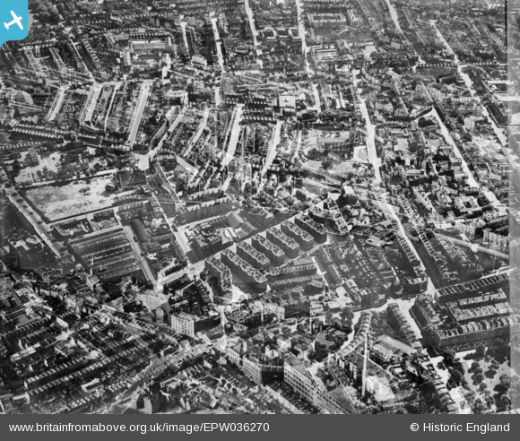
EPW036270 ENGLAND (1931). The Samuel Lewis Trust Dwellings, St Luke's Church and environs, Chelsea, 1931. This image has been produced from a double-exposed copy-negative.
© Hawlfraint cyfranwyr OpenStreetMap a thrwyddedwyd gan yr OpenStreetMap Foundation. 2026. Trwyddedir y gartograffeg fel CC BY-SA.
Delweddau cyfagos (13)
EPW036270

EPW035605

EPW035607

EPW036272

EPW036269

EPW036274

EPW036276

EPW035606

EPW036273

EPW036271

EPW060779

EPW036275

EPW060784

Manylion
| Pennawd | [EPW036270] The Samuel Lewis Trust Dwellings, St Luke's Church and environs, Chelsea, 1931. This image has been produced from a double-exposed copy-negative. |
| Cyfeirnod | EPW036270 |
| Dyddiad | August-1931 |
| Dolen | |
| Enw lle | CHELSEA |
| Plwyf | |
| Ardal | |
| Gwlad | ENGLAND |
| Dwyreiniad / Gogleddiad | 527223, 178506 |
| Hydred / Lledred | -0.16727975009532, 51.49068417061 |
| Cyfeirnod Grid Cenedlaethol | TQ272785 |
Pinnau
Byddwch y cyntaf i ychwanegu sylw at y ddelwedd hon!