
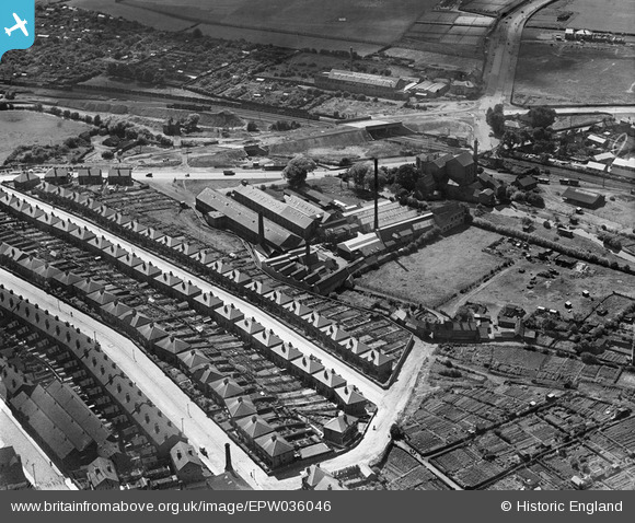
EPW036046 ENGLAND (1931). The Bobbers Mill Bleaching and Dyeing Works, Chadwick Road and Bobbers Mill Bridge under construction, Nottingham, 1931
© Hawlfraint cyfranwyr OpenStreetMap a thrwyddedwyd gan yr OpenStreetMap Foundation. 2026. Trwyddedir y gartograffeg fel CC BY-SA.
Delweddau cyfagos (16)
EPW036046

EPW036048

EPW036047

EPW036042

EPW036040

EPW036039

EPW036043

EPW036044

EPW036041

EPW036045

EPW054123

EPW054124

EPW054121

EPW054122

EPW054120

EPW054119

Manylion
| Pennawd | [EPW036046] The Bobbers Mill Bleaching and Dyeing Works, Chadwick Road and Bobbers Mill Bridge under construction, Nottingham, 1931 |
| Cyfeirnod | EPW036046 |
| Dyddiad | July-1931 |
| Dolen | |
| Enw lle | NOTTINGHAM |
| Plwyf | |
| Ardal | |
| Gwlad | ENGLAND |
| Dwyreiniad / Gogleddiad | 455148, 341378 |
| Hydred / Lledred | -1.1787957543871, 52.966611679671 |
| Cyfeirnod Grid Cenedlaethol | SK551414 |
Pinnau

KC |
Monday 28th of August 2023 10:50:20 AM |