
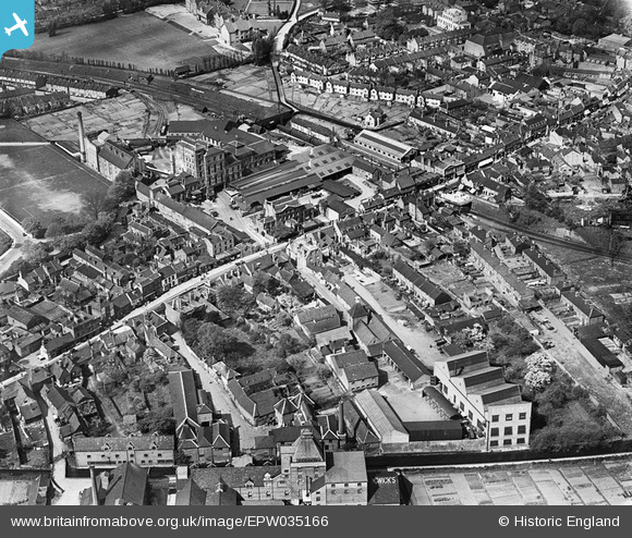
EPW035166 ENGLAND (1931). Benskins Brewery and the town, Watford, 1931
© Hawlfraint cyfranwyr OpenStreetMap a thrwyddedwyd gan yr OpenStreetMap Foundation. 2026. Trwyddedir y gartograffeg fel CC BY-SA.
Delweddau cyfagos (22)
EPW035166

 0°
0m
EPW035164
 180°
4m
EPW035167
 135°
9m
EAW026503
 197°
13m
EPW035165
 42°
13m
EPW034812
 264°
19m
EPW035129
 336°
19m
EPW035163
 110°
23m
EPW034809
 168°
28m
EPW034811
 197°
38m
EPW034808
 212°
41m
EPW034814
 302°
44m
EPW034779
 262°
59m
EPW034813
 88°
74m
EPW034807
 235°
84m
EPW034781
 237°
85m
EPW034810
 237°
88m
EAW022727
 153°
104m
EPW035168
 249°
104m
EPW034780
 246°
129m
EAW026504
 307°
154m
EAW002186
 285°
165m
Manylion
| Pennawd | [EPW035166] Benskins Brewery and the town, Watford, 1931 |
| Cyfeirnod | EPW035166 |
| Dyddiad | May-1931 |
| Dolen | |
| Enw lle | WATFORD |
| Plwyf | |
| Ardal | |
| Gwlad | ENGLAND |
| Dwyreiniad / Gogleddiad | 511443, 196044 |
| Hydred / Lledred | -0.38893220900084, 51.651661832043 |
| Cyfeirnod Grid Cenedlaethol | TQ114960 |
Pinnau
 These two houses, numbers 212 and 214, are among the very few old buildings still standing in the Lower High .street. |

Paul |
Sunday 8th of November 2026 04:25:49 PM |
| Watford High Street station |
Paul |
Sunday 8th of November 2026 11:04:22 AM |
| Former Watford Museum building |
Paul |
Sunday 8th of November 2026 11:03:27 AM |
| The Swan public house |
Paul |
Sunday 8th of November 2026 11:02:02 AM |