
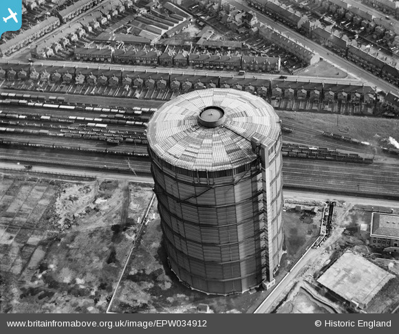
EPW034912 ENGLAND (1931). The Southall Gasometer opposite Queen's Road, Southall, 1931
© Hawlfraint cyfranwyr OpenStreetMap a thrwyddedwyd gan yr OpenStreetMap Foundation. 2026. Trwyddedir y gartograffeg fel CC BY-SA.
Delweddau cyfagos (2)
EPW034912

EPW034913

Manylion
| Pennawd | [EPW034912] The Southall Gasometer opposite Queen's Road, Southall, 1931 |
| Cyfeirnod | EPW034912 |
| Dyddiad | March-1931 |
| Dolen | |
| Enw lle | SOUTHALL |
| Plwyf | |
| Ardal | |
| Gwlad | ENGLAND |
| Dwyreiniad / Gogleddiad | 511919, 179716 |
| Hydred / Lledred | -0.38725840954318, 51.504797966016 |
| Cyfeirnod Grid Cenedlaethol | TQ119797 |
Pinnau

southallboy |
Tuesday 5th of February 2013 04:49:11 PM | |
|
southallboy |
Tuesday 5th of February 2013 04:42:07 PM | |
|
southallboy |
Tuesday 5th of February 2013 04:40:56 PM |