
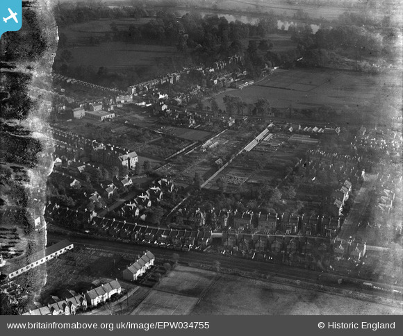
EPW034755 ENGLAND (1930). Orleans Park and housing off Amyand Park Road, Twickenham, 1930. This image has been produced from a damaged negative.
© Hawlfraint cyfranwyr OpenStreetMap a thrwyddedwyd gan yr OpenStreetMap Foundation. 2026. Trwyddedir y gartograffeg fel CC BY-SA.
Delweddau cyfagos (9)
EPW034755

EPW034762

EPW034761

EPW034759

EPW034757

EPW034760

EPW034756

EPW034763

EPW034758

Manylion
| Pennawd | [EPW034755] Orleans Park and housing off Amyand Park Road, Twickenham, 1930. This image has been produced from a damaged negative. |
| Cyfeirnod | EPW034755 |
| Dyddiad | 29-October-1930 |
| Dolen | |
| Enw lle | TWICKENHAM |
| Plwyf | |
| Ardal | |
| Gwlad | ENGLAND |
| Dwyreiniad / Gogleddiad | 516691, 173864 |
| Hydred / Lledred | -0.3204591297119, 51.451230905368 |
| Cyfeirnod Grid Cenedlaethol | TQ167739 |
Pinnau

Delboy |
Tuesday 16th of September 2014 04:53:16 PM |
Cyfraniadau Grŵp
Orleans Lodge visible. Boundary wall not apparent. Suggests wall removed when Richmond Road widened with new wall added at a later date (circa 1973 when Orleans School formed?). |
GMH |
Tuesday 28th of January 2014 01:18:36 AM |