
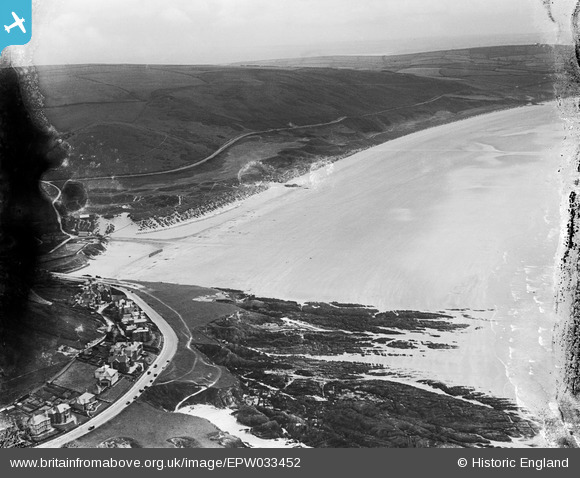
EPW033452 ENGLAND (1930). Shellsborough Cove, Woolacombe Sand and Woolacombe Down, Woolacombe, from the north-west, 1930. This image has been produced from a damaged negative.
© Hawlfraint cyfranwyr OpenStreetMap a thrwyddedwyd gan yr OpenStreetMap Foundation. 2026. Trwyddedir y gartograffeg fel CC BY-SA.
Delweddau cyfagos (2)
EPW033452

EPW039872

Manylion
| Pennawd | [EPW033452] Shellsborough Cove, Woolacombe Sand and Woolacombe Down, Woolacombe, from the north-west, 1930. This image has been produced from a damaged negative. |
| Cyfeirnod | EPW033452 |
| Dyddiad | July-1930 |
| Dolen | |
| Enw lle | WOOLACOMBE |
| Plwyf | MORTEHOE |
| Ardal | |
| Gwlad | ENGLAND |
| Dwyreiniad / Gogleddiad | 245379, 143921 |
| Hydred / Lledred | -4.2121005919377, 51.173074121822 |
| Cyfeirnod Grid Cenedlaethol | SS454439 |
Pinnau
Byddwch y cyntaf i ychwanegu sylw at y ddelwedd hon!