
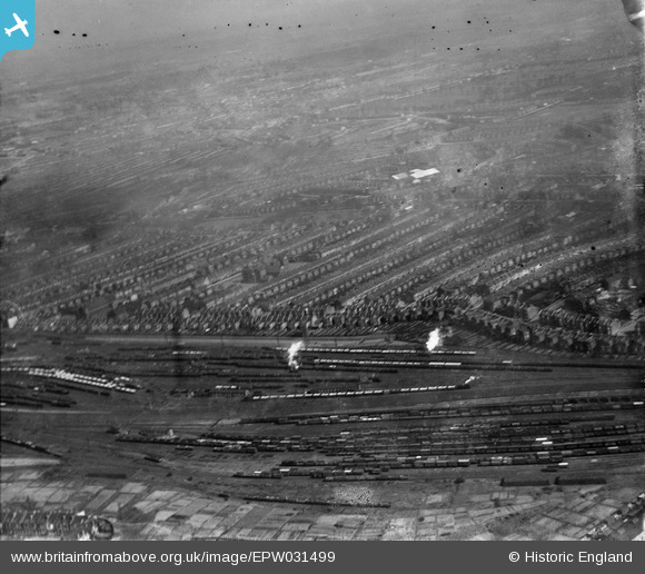
EPW031499 ENGLAND (1930). Ferme Park Sidings, terraced housing along Wightman Road and environs, Harringay, from the south-west, 1930
© Hawlfraint cyfranwyr OpenStreetMap a thrwyddedwyd gan yr OpenStreetMap Foundation. 2026. Trwyddedir y gartograffeg fel CC BY-SA.
Delweddau cyfagos (2)
EPW031499

EAW034516

Manylion
| Pennawd | [EPW031499] Ferme Park Sidings, terraced housing along Wightman Road and environs, Harringay, from the south-west, 1930 |
| Cyfeirnod | EPW031499 |
| Dyddiad | February-1930 |
| Dolen | |
| Enw lle | HARRINGAY |
| Plwyf | |
| Ardal | |
| Gwlad | ENGLAND |
| Dwyreiniad / Gogleddiad | 531146, 188778 |
| Hydred / Lledred | -0.10697206808417, 51.582107830315 |
| Cyfeirnod Grid Cenedlaethol | TQ311888 |
Pinnau

Class31 |
Wednesday 13th of February 2013 02:50:23 PM | |
|
Class31 |
Wednesday 13th of February 2013 02:49:06 PM | |
|
Class31 |
Wednesday 13th of February 2013 02:48:36 PM | |
|
Class31 |
Wednesday 13th of February 2013 02:48:03 PM | |
|
Class31 |
Wednesday 13th of February 2013 02:47:40 PM | |
|
Class31 |
Wednesday 13th of February 2013 02:47:09 PM | |

AlexSmee |
Sunday 16th of December 2012 05:30:31 PM | |
|
Richard Woods |
Wednesday 18th of July 2012 04:30:45 PM |