
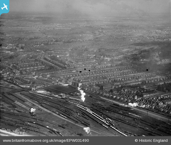
EPW031490 ENGLAND (1930). Ferme Park Sidings, St Peter's Church and environs, Harringay, from the south, 1930
© Hawlfraint cyfranwyr OpenStreetMap a thrwyddedwyd gan yr OpenStreetMap Foundation. 2026. Trwyddedir y gartograffeg fel CC BY-SA.
Delweddau cyfagos (2)
EPW031490

EAW034516

Manylion
| Pennawd | [EPW031490] Ferme Park Sidings, St Peter's Church and environs, Harringay, from the south, 1930 |
| Cyfeirnod | EPW031490 |
| Dyddiad | February-1930 |
| Dolen | |
| Enw lle | HARRINGAY |
| Plwyf | |
| Ardal | |
| Gwlad | ENGLAND |
| Dwyreiniad / Gogleddiad | 531095, 189132 |
| Hydred / Lledred | -0.10757558914475, 51.585301261864 |
| Cyfeirnod Grid Cenedlaethol | TQ311891 |
Pinnau

ChristopherD |
Friday 11th of July 2014 02:59:21 AM | |

Class31 |
Wednesday 13th of February 2013 04:25:51 PM | |
|
Class31 |
Wednesday 13th of February 2013 04:25:16 PM | |
|
Class31 |
Wednesday 13th of February 2013 04:23:09 PM | |
|
Richard Woods |
Wednesday 18th of July 2012 04:24:29 PM |
Cyfraniadau Grŵp
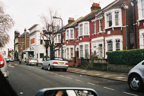
Terrific picture for me. I lived in the road between the church (St Peter's) and the school - near the bottom - from 1945 to 1960. My picture shows the end of the road - houses are typical; the large building was a cinema in my day. |
Richard Woods |
Wednesday 18th of July 2012 04:28:24 PM |