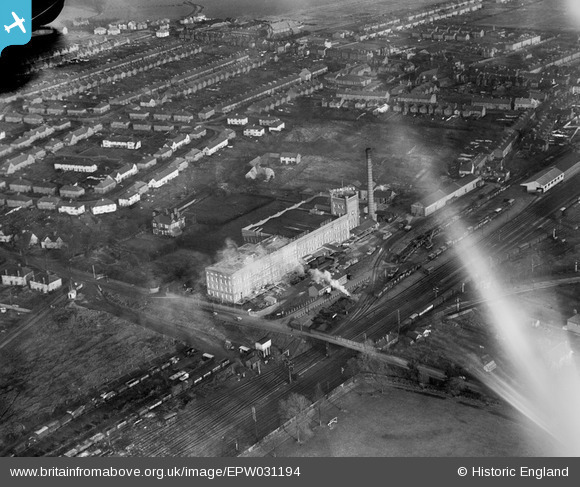
EPW031194 ENGLAND (1929). The Horlicks Malted Milk Factory and environs, Slough, 1929
© Hawlfraint cyfranwyr OpenStreetMap a thrwyddedwyd gan yr OpenStreetMap Foundation. 2026. Trwyddedir y gartograffeg fel CC BY-SA.
Delweddau cyfagos (27)
EPW031194

EPW031196

EPW031193

EPW021891

EPW021892

EPW031197

EPW008010

EPW021789

EPW031198

EPW031195

EPW021893

EPW021790

EPW021896

EPW031607

EPW021787

EPW021889

EPW021788

EPW021894

EPW021785

EPW021895

EPW031606

EPW031608

EPW021890

EPW021786

EPW021888

EPW031603

EPW051468

Manylion
| Pennawd | [EPW031194] The Horlicks Malted Milk Factory and environs, Slough, 1929 |
| Cyfeirnod | EPW031194 |
| Dyddiad | 21-November-1929 |
| Dolen | |
| Enw lle | SLOUGH |
| Plwyf | |
| Ardal | |
| Gwlad | ENGLAND |
| Dwyreiniad / Gogleddiad | 497279, 180412 |
| Hydred / Lledred | -0.59795423023277, 51.513765242152 |
| Cyfeirnod Grid Cenedlaethol | SU973804 |
Pinnau

Class31 |
Wednesday 3rd of July 2013 09:04:50 PM | |
|
Class31 |
Wednesday 3rd of July 2013 08:50:48 PM | |
|
Class31 |
Wednesday 3rd of July 2013 07:53:56 PM | |
|
Class31 |
Wednesday 3rd of July 2013 07:04:32 PM | |
|
Class31 |
Wednesday 3rd of July 2013 06:55:53 PM | |
|
Class31 |
Wednesday 3rd of July 2013 06:44:55 PM |