
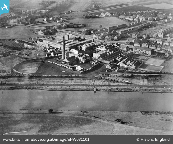
EPW031101 ENGLAND (1929). The Co-Operative Wholesale Society Lard Refinery and Margarine Works, Irlam, 1929
© Hawlfraint cyfranwyr OpenStreetMap a thrwyddedwyd gan yr OpenStreetMap Foundation. 2026. Trwyddedir y gartograffeg fel CC BY-SA.
Delweddau cyfagos (7)
EPW031101

EPW031040

EPW027875

EPW031038

EPW031037

EPW031039

EPW031103

Manylion
| Pennawd | [EPW031101] The Co-Operative Wholesale Society Lard Refinery and Margarine Works, Irlam, 1929 |
| Cyfeirnod | EPW031101 |
| Dyddiad | October-1929 |
| Dolen | |
| Enw lle | IRLAM |
| Plwyf | |
| Ardal | |
| Gwlad | ENGLAND |
| Dwyreiniad / Gogleddiad | 373092, 395093 |
| Hydred / Lledred | -2.4052325005049, 53.451653299902 |
| Cyfeirnod Grid Cenedlaethol | SJ731951 |
