
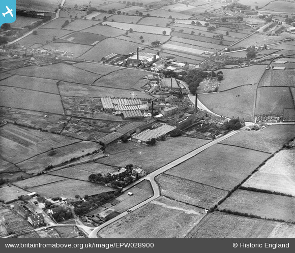
EPW028900 ENGLAND (1929). Half Mile Lane and Woollen and Worsted Mills along Coal Hill Lane, Farsley Beck Bottom, 1929
© Hawlfraint cyfranwyr OpenStreetMap a thrwyddedwyd gan yr OpenStreetMap Foundation. 2026. Trwyddedir y gartograffeg fel CC BY-SA.
Delweddau cyfagos (7)
EPW028900

EPW028898

EPW028899

EPW028901

EPW028896

EPW028897

EPW028893

Manylion
| Pennawd | [EPW028900] Half Mile Lane and Woollen and Worsted Mills along Coal Hill Lane, Farsley Beck Bottom, 1929 |
| Cyfeirnod | EPW028900 |
| Dyddiad | August-1929 |
| Dolen | |
| Enw lle | FARSLEY BECK BOTTOM |
| Plwyf | |
| Ardal | |
| Gwlad | ENGLAND |
| Dwyreiniad / Gogleddiad | 422362, 435391 |
| Hydred / Lledred | -1.6603314200283, 53.81410881837 |
| Cyfeirnod Grid Cenedlaethol | SE224354 |
Pinnau

Eccles Web |
Thursday 14th of November 2013 04:15:30 PM | |
|
Eccles Web |
Thursday 14th of November 2013 04:14:29 PM | |
|
Eccles Web |
Thursday 14th of November 2013 04:13:33 PM | |
|
Eccles Web |
Thursday 14th of November 2013 04:11:28 PM | |
|
Eccles Web |
Thursday 14th of November 2013 04:09:07 PM | |
|
farsleyflyer |
Saturday 20th of October 2012 08:54:39 AM | |
|
farsleyflyer |
Saturday 20th of October 2012 08:54:05 AM | |
|
farsleyflyer |
Saturday 20th of October 2012 08:53:36 AM | |
|
farsleyflyer |
Saturday 20th of October 2012 08:53:03 AM |