
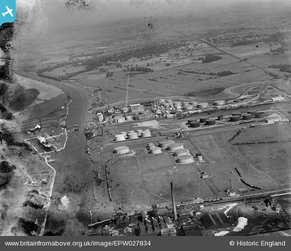
EPW027834 ENGLAND (1929). The Stanlow Oil Refinery, Oil Docks and the Manchester Ship Canal, Stanlow, from the west, 1929. This image has been produced from a damaged negative.
© Hawlfraint cyfranwyr OpenStreetMap a thrwyddedwyd gan yr OpenStreetMap Foundation. 2026. Trwyddedir y gartograffeg fel CC BY-SA.
Delweddau cyfagos (12)
EPW027834

EPW018810

EPW018809

EPW018806

EPW018807

EPW027840

EAW008711

EPW018813

EPW027839

EPW018808

EPW018811

EAW012360

Manylion
| Pennawd | [EPW027834] The Stanlow Oil Refinery, Oil Docks and the Manchester Ship Canal, Stanlow, from the west, 1929. This image has been produced from a damaged negative. |
| Cyfeirnod | EPW027834 |
| Dyddiad | June-1929 |
| Dolen | |
| Enw lle | STANLOW |
| Plwyf | |
| Ardal | |
| Gwlad | ENGLAND |
| Dwyreiniad / Gogleddiad | 342255, 376834 |
| Hydred / Lledred | -2.8662565295878, 53.285052476331 |
| Cyfeirnod Grid Cenedlaethol | SJ423768 |
Pinnau
Byddwch y cyntaf i ychwanegu sylw at y ddelwedd hon!