
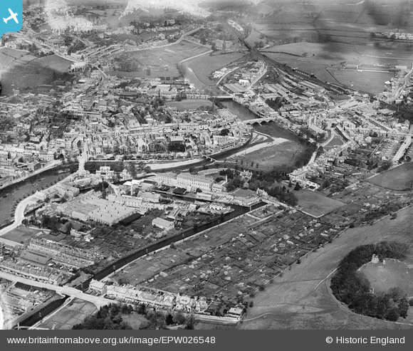
EPW026548 ENGLAND (1929). The town centre, Kendal, from the south-east, 1929
© Hawlfraint cyfranwyr OpenStreetMap a thrwyddedwyd gan yr OpenStreetMap Foundation. 2026. Trwyddedir y gartograffeg fel CC BY-SA.
Delweddau cyfagos (21)
EPW026548

EPW026579

EPW026747

EPW026753

EPW026751

EPW026752

EPW026755

EPW026756

EPW026748

EPW026754

EAW043388

EPW026749

EPW026750

EPW026746

EPW026540

EAW043387

EAW043389

EAW043386

EPW026811

EPW038831

EPW026542

Manylion
| Pennawd | [EPW026548] The town centre, Kendal, from the south-east, 1929 |
| Cyfeirnod | EPW026548 |
| Dyddiad | May-1929 |
| Dolen | |
| Enw lle | KENDAL |
| Plwyf | KENDAL |
| Ardal | |
| Gwlad | ENGLAND |
| Dwyreiniad / Gogleddiad | 351963, 492515 |
| Hydred / Lledred | -2.7386921221967, 54.325793625244 |
| Cyfeirnod Grid Cenedlaethol | SD520925 |
Pinnau
Cyfraniadau Grŵp
Lost terminus of the Lancaster Canal at Canal Head, Kendal. |

Richard Fairhurst |
Monday 9th of July 2012 12:21:02 PM |
Kendal Cricket Club is top right, alongside the railway line. |
Doodleshire |
Tuesday 26th of June 2012 04:05:31 PM |