
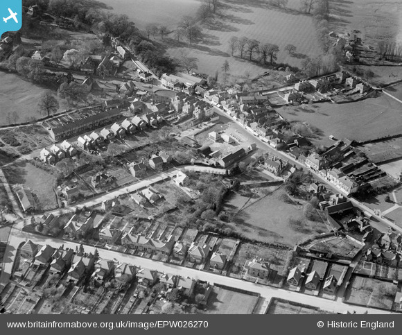
EPW026270 ENGLAND (1929). Limes Road and environs, Egham, 1929
© Hawlfraint cyfranwyr OpenStreetMap a thrwyddedwyd gan yr OpenStreetMap Foundation. 2026. Trwyddedir y gartograffeg fel CC BY-SA.
Delweddau cyfagos (4)
EPW026270

EPW023511

EPW026269

EAW002313

Manylion
| Pennawd | [EPW026270] Limes Road and environs, Egham, 1929 |
| Cyfeirnod | EPW026270 |
| Dyddiad | 25-April-1929 |
| Dolen | |
| Enw lle | EGHAM |
| Plwyf | |
| Ardal | |
| Gwlad | ENGLAND |
| Dwyreiniad / Gogleddiad | 500721, 171226 |
| Hydred / Lledred | -0.55098179948689, 51.430582877359 |
| Cyfeirnod Grid Cenedlaethol | TQ007712 |
Pinnau

David960 |
Tuesday 9th of May 2023 12:11:35 PM | |
|
Ellensdottir |
Sunday 1st of September 2013 09:15:23 PM | |
|
Ellensdottir |
Sunday 1st of September 2013 09:14:26 PM | |
|
Ellensdottir |
Sunday 1st of September 2013 09:13:10 PM | |

Class31 |
Tuesday 30th of October 2012 04:40:32 PM | |
|
Class31 |
Tuesday 30th of October 2012 04:39:50 PM | |
|
Class31 |
Tuesday 30th of October 2012 04:39:31 PM | |
|
Class31 |
Tuesday 30th of October 2012 04:39:01 PM |