
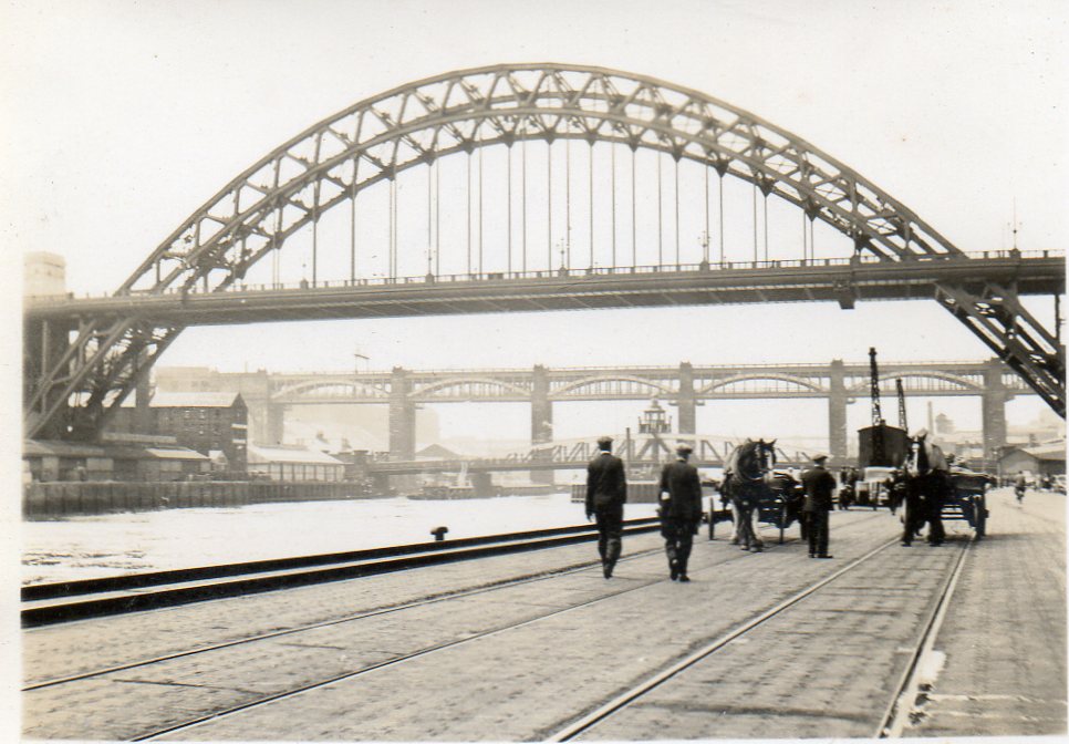
EPW025015 ENGLAND (1928). Newcastle-upon-Tyne, the day of the opening of the Tyne Bridge, 1928

© Hawlfraint cyfranwyr OpenStreetMap a thrwyddedwyd gan yr OpenStreetMap Foundation. 2026. Trwyddedir y gartograffeg fel CC BY-SA.
Delweddau cyfagos (23)
EPW025015

EPW048263

EPW020569

EPW048799

EPW020570

EPW048805

EPW019820

EPW048345

EPW020568

EPW025016

EPW054561

EPW048229

EPW054559

EPW048803

EPW048346

EPW048235

EPW048800

EPW010393

EPW010383

EPW051090

EPW048230

EAW017459

EAW405203

Manylion
| Pennawd | [EPW025015] Newcastle-upon-Tyne, the day of the opening of the Tyne Bridge, 1928 |
| Cyfeirnod | EPW025015 |
| Dyddiad | 10-October-1928 |
| Dolen | |
| Enw lle | NEWCASTLE-UPON-TYNE |
| Plwyf | |
| Ardal | |
| Gwlad | ENGLAND |
| Dwyreiniad / Gogleddiad | 425353, 563858 |
| Hydred / Lledred | -1.6039341258847, 54.968622229395 |
| Cyfeirnod Grid Cenedlaethol | NZ254639 |
Pinnau

Brigham |
Thursday 23rd of July 2015 06:17:58 PM | |
|
history group |
Thursday 25th of April 2013 02:48:30 PM | |
|
history group |
Thursday 25th of April 2013 02:46:32 PM | |
|
history group |
Thursday 25th of April 2013 02:45:18 PM | |
|
history group |
Thursday 25th of April 2013 02:45:18 PM | |
|
JonB |
Wednesday 2nd of January 2013 02:23:10 PM |

Cyfraniadau Grŵp

The description of this image has been produced by the group. To listen to an audio of this description watch the video below. This picture shows the Tyne Bridge as it was being built. The pale concrete towers on the Gateshead side are not finished. These towers had lifts inside them, which people used when they wanted to get down to the riverside from the bridge. The High Level Bridge on the left of the picture provides a wonderful view for people travelling north into Newcastle by train. It also provided a clear view of the great fire which caused so much damage to people and property in Gateshead and Newcastle in 1854. The picture shows St Mary's church on the Gateshead side of the river, near the Tyne Bridge. This area was affected by the fire. The Swing Bridge (the middle bridge) used to sound its horn to warn people it was about to open. The carriageway of the bridge would swing round into the middle of the River Tyne, allowing the ships to pass. The sound of the horn could be heard all over central Gateshead and Newcastle. |
Sandra Brauer |
Friday 11th of April 2014 04:23:52 PM |
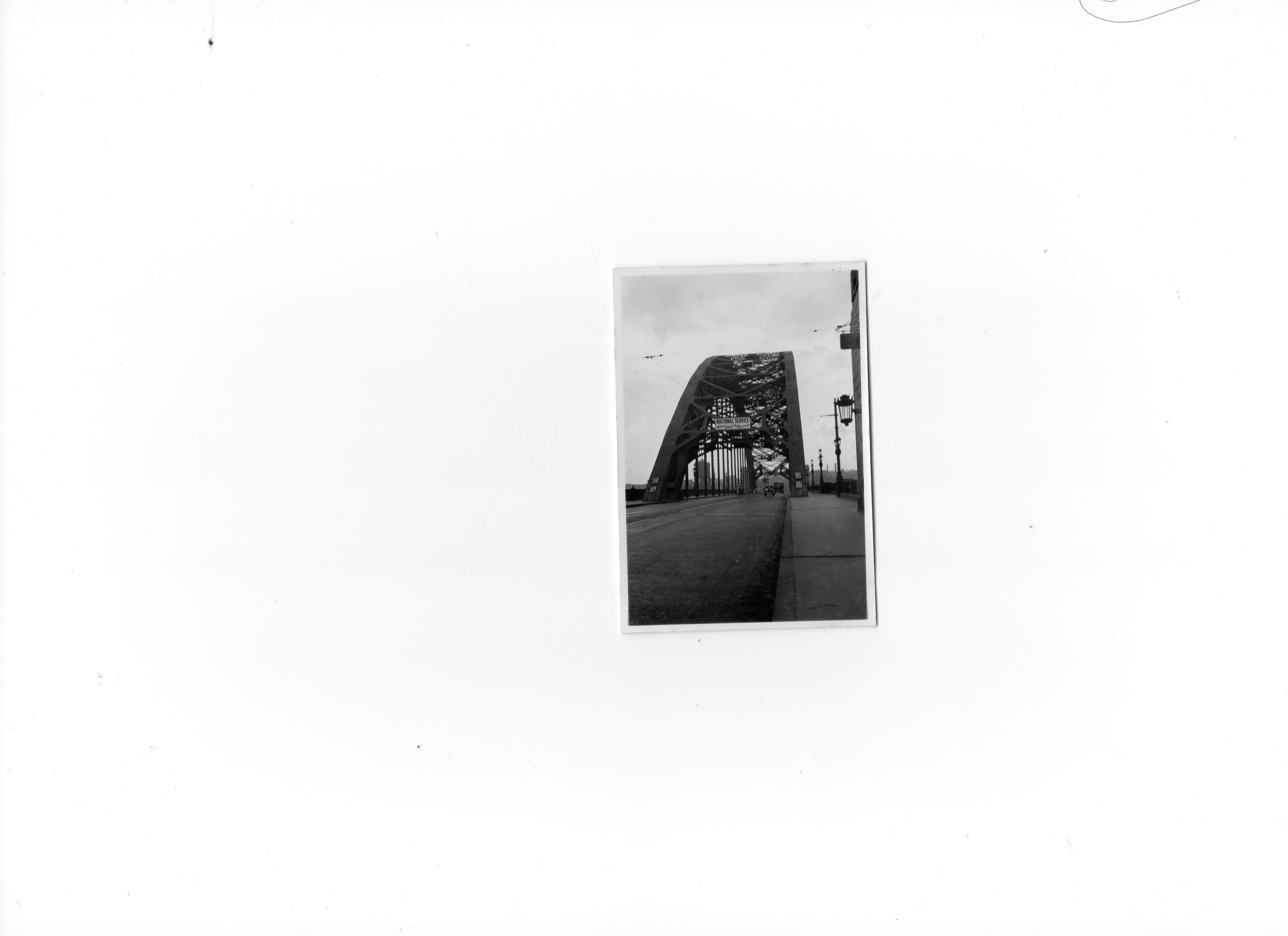
Snapshot of the Tyne Bridge taken June or July 1939 |

Class31 |
Monday 7th of April 2014 04:09:10 PM |
Snapshot taken from Quayside June or July 1939 |
Class31 |
Monday 7th of April 2014 04:03:28 PM |
Here is an audio of a description of this image, produced by blind and partially sighted users of Sight Service Gateshead during a partnership project with Britain from Above. Speaker is Dr Dorothy Hamilton, project lead. |
Sandra Brauer |
Friday 30th of August 2013 11:07:36 AM |
This picture shows the Tyne Bridge as it was being built. The pale concrete towers on the Gateshead side are not finished. These towers had lifts inside them, which people used when they wanted to get down to the riverside from the bridge. The High Level Bridge on the left of the picture provides a wonderful view for people travelling north into Newcastle by train. It also provided a clear view of the great fire which caused so much damage to people and property in Gateshead and Newcastle in 1854. The picture shows St Mary's church on the Gateshead side of the river, near the Tyne Bridge. This area was affected by the fire. The Swing Bridge (the middle bridge) used to sound its horn to warn people it was about to open. The carriageway of the bridge would swing round into the middle of the River Tyne, allowing the ships to pass. The sound of the horn could be heard all over central Gateshead and Newcastle. |
history group |
Thursday 21st of March 2013 03:53:11 PM |