
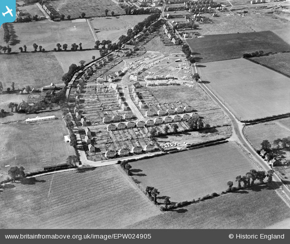
EPW024905 ENGLAND (1928). New housing under construction between Corringham Road and Billet Lane, Stanford-le-Hope, 1928
© Hawlfraint cyfranwyr OpenStreetMap a thrwyddedwyd gan yr OpenStreetMap Foundation. 2026. Trwyddedir y gartograffeg fel CC BY-SA.
Delweddau cyfagos (5)
EPW024905

EPW024900

EPW024903

EAW024610

EAW024611

Manylion
| Pennawd | [EPW024905] New housing under construction between Corringham Road and Billet Lane, Stanford-le-Hope, 1928 |
| Cyfeirnod | EPW024905 |
| Dyddiad | 3-October-1928 |
| Dolen | |
| Enw lle | STANFORD-LE-HOPE |
| Plwyf | |
| Ardal | |
| Gwlad | ENGLAND |
| Dwyreiniad / Gogleddiad | 569447, 182454 |
| Hydred / Lledred | 0.44235781818135, 51.515077937543 |
| Cyfeirnod Grid Cenedlaethol | TQ694825 |
Pinnau
Cyfraniadau Grŵp
Photo taken from East (fact, not deduction). See also EPW024900 & EPW024903. |

BigglesH |
Monday 16th of July 2012 09:37:11 PM |