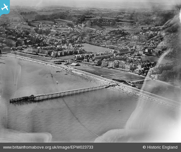
EPW023733 ENGLAND (1928). Promenade Pier and The Green, Paignton, from the north-east, 1928
    © Hawlfraint cyfranwyr OpenStreetMap a thrwyddedwyd gan yr OpenStreetMap Foundation. 2025. Trwyddedir y gartograffeg fel CC BY-SA.
  
Delweddau cyfagos (5)
Manylion
| Pennawd | [EPW023733] Promenade Pier and The Green, Paignton, from the north-east, 1928 | 
| Cyfeirnod | EPW023733 | 
| Dyddiad | October-1928 | 
| Dolen | |
| Enw lle | PAIGNTON | 
| Plwyf | |
| Ardal | |
| Gwlad | ENGLAND | 
| Dwyreiniad / Gogleddiad | 289496, 60913 | 
| Hydred / Lledred | -3.5562441791596, 50.43704649197 | 
| Cyfeirnod Grid Cenedlaethol | SX895609 | 
 
             
  ![[EPW023733] Promenade Pier and The Green, Paignton, from the north-east, 1928](http://britainfromabove.org.uk/sites/all/libraries/aerofilms-images/public/100x100/EPW/023/EPW023733.jpg) 
  
                                          ![[EPW023734] Promenade Pier and environs, Paignton, 1928](http://britainfromabove.org.uk/sites/all/libraries/aerofilms-images/public/100x100/EPW/023/EPW023734.jpg) 
 ![[EPW023732] Paignton Sands and The Promenade, Paignton, 1928](http://britainfromabove.org.uk/sites/all/libraries/aerofilms-images/public/100x100/EPW/023/EPW023732.jpg) 
 ![[EPW023735] Paignton seafront, Paignton, from the east, 1928](http://britainfromabove.org.uk/sites/all/libraries/aerofilms-images/public/100x100/EPW/023/EPW023735.jpg) 
 ![[EPW023712] The Green and Paignton Sands, Paignton, 1928](http://britainfromabove.org.uk/sites/all/libraries/aerofilms-images/public/100x100/EPW/023/EPW023712.jpg) 
  Inn on the Green
 Inn on the Green 