
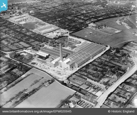
EPW020945 ENGLAND (1928). Unidentified factory near the Perambulator Works, Old Basford, 1928
© Hawlfraint cyfranwyr OpenStreetMap a thrwyddedwyd gan yr OpenStreetMap Foundation. 2026. Trwyddedir y gartograffeg fel CC BY-SA.
Delweddau cyfagos (28)
EPW020945

EPW021110

EAW003245

EPW020944

EAW002792
 and the Saxby Ltd Dyeing Works off Bar Lane, Old Basford, 1946")
EAW003244

EAW052448

EAW003246

EAW002790

EAW002791

EAW052451

EAW002789

EAW052446
 on Bar Lane and environs, Old Basford, from the south, 1953. This image was marked by Aerofilms Ltd for photo editing.")
EAW002788
 and the Saxby Ltd Dyeing Works off Bar Lane, Old Basford, 1946")
EAW052447

EAW052480

EAW002787
 and the Saxby Ltd Dyeing Works off Bar Lane, Old Basford, 1946")
EAW052444
 on Bar Lane and environs, Old Basford, 1953. This image was marked by Aerofilms Ltd for photo editing.")
EPW038034

EAW052443
 on Bar Lane, Bracknell Crescent and environs, Old Basford, 1953. This image was marked by Aerofilms Ltd for photo editing.")
EAW052445
 on Bar Lane and environs, Old Basford, 1953. This image was marked by Aerofilms Ltd for photo editing.")
EPW038032

EAW002794
 and the surrounding area, Old Basford, from the west, 1946")
EAW002793
, Bar Lane and the surrounding area, Old Basford, 1946")
EAW002795
 and the surrounding area, Old Basford, from the south-east, 1946")
EAW052449
 on Bar Lane and environs, Old Basford, 1953. This image was marked by Aerofilms Ltd for photo editing.")
EPW020941

EPW021111

Manylion
| Pennawd | [EPW020945] Unidentified factory near the Perambulator Works, Old Basford, 1928 |
| Cyfeirnod | EPW020945 |
| Dyddiad | April-1928 |
| Dolen | |
| Enw lle | OLD BASFORD |
| Plwyf | |
| Ardal | |
| Gwlad | ENGLAND |
| Dwyreiniad / Gogleddiad | 454669, 342675 |
| Hydred / Lledred | -1.1857085885748, 52.978319923305 |
| Cyfeirnod Grid Cenedlaethol | SK547427 |
Pinnau
Byddwch y cyntaf i ychwanegu sylw at y ddelwedd hon!
Cyfraniadau Grŵp
The unidentified factory ...is Saxbys Dye works. the two rectangular buildings above it are the former Guilford girls school and the lower Ellis boys school. They appear to be still underconstruction ..which would make the date in the early twenties. the road running between the school and the dye works is Bar Lane . |

FATKAT |
Monday 25th of June 2012 06:22:05 PM |