
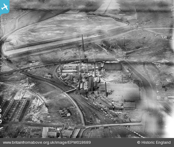
EPW018689 ENGLAND (1927). Forster's Glass Co. Ltd. Atlas Works, St Helens, 1927
© Hawlfraint cyfranwyr OpenStreetMap a thrwyddedwyd gan yr OpenStreetMap Foundation. 2026. Trwyddedir y gartograffeg fel CC BY-SA.
Delweddau cyfagos (5)
EPW018689

EPW018693

EPW018692

EPW018691

EPW018690

Manylion
| Pennawd | [EPW018689] Forster's Glass Co. Ltd. Atlas Works, St Helens, 1927 |
| Cyfeirnod | EPW018689 |
| Dyddiad | July-1927 |
| Dolen | |
| Enw lle | ST HELENS |
| Plwyf | |
| Ardal | |
| Gwlad | ENGLAND |
| Dwyreiniad / Gogleddiad | 351862, 396025 |
| Hydred / Lledred | -2.7250755360317, 53.458518793875 |
| Cyfeirnod Grid Cenedlaethol | SJ519960 |
Pinnau

Jacksprat |
Tuesday 12th of November 2019 06:11:26 PM | |
|
beast66606 |
Wednesday 1st of May 2013 03:23:23 PM | |
|
Derrick Jones |
Saturday 13th of April 2013 03:43:18 PM | |
|
lookingin |
Saturday 28th of July 2012 09:40:40 PM | |
|
lookingin |
Saturday 28th of July 2012 09:39:59 PM | |
|
lookingin |
Saturday 28th of July 2012 09:39:22 PM | |
|
Paul Pritchard |
Tuesday 26th of June 2012 04:53:17 PM | |
|
Paul Pritchard |
Tuesday 26th of June 2012 04:49:53 PM | |
|
Paul Pritchard |
Tuesday 26th of June 2012 04:45:51 PM | |
|
Paul Pritchard |
Tuesday 26th of June 2012 04:43:44 PM |