
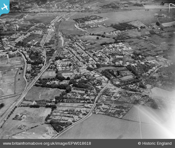
EPW018618 ENGLAND (1927). Canterbury Road and the Faversham and Ramsgate Harbour railway line, Whitstable, from the south-west, 1927
© Hawlfraint cyfranwyr OpenStreetMap a thrwyddedwyd gan yr OpenStreetMap Foundation. 2026. Trwyddedir y gartograffeg fel CC BY-SA.
Delweddau cyfagos (7)
EPW018618

 0°
0m
0°
0m
EAW023150
 25°
16m
25°
16m
EAW023151
 350°
23m
350°
23m
EAW023154
 62°
29m
62°
29m
EAW023152
 352°
30m
352°
30m
EAW023149
 37°
37m
37°
37m
EAW023153
 39°
102m
39°
102m
Manylion
| Pennawd | [EPW018618] Canterbury Road and the Faversham and Ramsgate Harbour railway line, Whitstable, from the south-west, 1927 |
| Cyfeirnod | EPW018618 |
| Dyddiad | 22-June-1927 |
| Dolen | |
| Enw lle | WHITSTABLE |
| Plwyf | |
| Ardal | |
| Gwlad | ENGLAND |
| Dwyreiniad / Gogleddiad | 610406, 165616 |
| Hydred / Lledred | 1.0219267027448, 51.35010470422 |
| Cyfeirnod Grid Cenedlaethol | TR104656 |
Pinnau
 Golf Course Golf Course |

Sparky |
Friday 29th of December 2017 11:15:33 PM |
| Borstal Hill |
Sparky |
Sunday 13th of August 2017 12:34:32 PM |
| Water Pumping Station |
Sparky |
Sunday 13th of August 2017 12:34:12 PM |
| Waypost House Hall requisitioned as WW2 ARP Post |
Sparky |
Sunday 13th of August 2017 12:33:29 PM |
| Borstal Farm |
Sparky |
Sunday 13th of August 2017 12:32:38 PM |
| Joy Lane |
Sparky |
Sunday 13th of August 2017 12:31:50 PM |
| Whitstable Gas works - one of holders had WHITSTABLE painted on the top that had to be obscured at the outbreak of WW2 |
Sparky |
Tuesday 11th of July 2017 01:19:30 PM |
| Whitstable Train Station - opened as Whitstable & Tankerton Station in 1915 |

Ian |
Monday 22nd of October 2012 07:53:07 AM |