
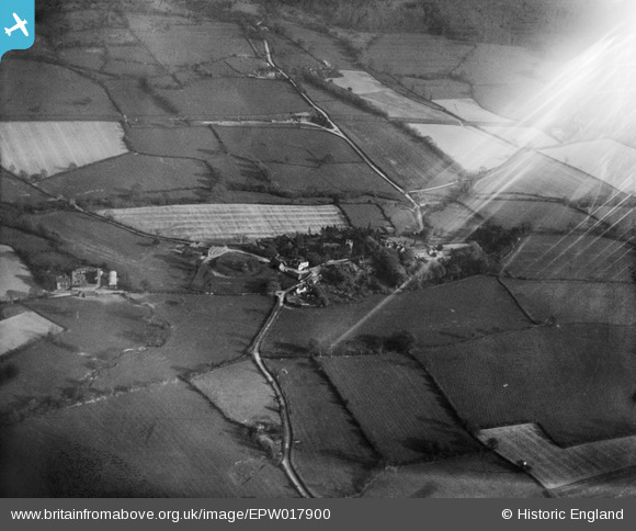
EPW017900 ENGLAND (1927). The Castle Mound and the village, Rushbury, 1927
© Hawlfraint cyfranwyr OpenStreetMap a thrwyddedwyd gan yr OpenStreetMap Foundation. 2026. Trwyddedir y gartograffeg fel CC BY-SA.
Delweddau cyfagos (4)
EPW017900

EPW017902

EPW017899

EPW017898

Manylion
| Pennawd | [EPW017900] The Castle Mound and the village, Rushbury, 1927 |
| Cyfeirnod | EPW017900 |
| Dyddiad | 11-May-1927 |
| Dolen | |
| Enw lle | RUSHBURY |
| Plwyf | RUSHBURY |
| Ardal | |
| Gwlad | ENGLAND |
| Dwyreiniad / Gogleddiad | 351387, 291857 |
| Hydred / Lledred | -2.7165608490692, 52.522055497927 |
| Cyfeirnod Grid Cenedlaethol | SO514919 |
Pinnau

Class31 |
Monday 9th of July 2012 08:37:03 AM | |
|
Class31 |
Monday 9th of July 2012 08:36:41 AM | |
|
Class31 |
Monday 9th of July 2012 08:36:09 AM | |

Hamish Fenton |
Monday 25th of June 2012 11:04:13 PM | |
Dear Hamish, That’s great; we’ve reviewed your comments and thanks to your help we can update the catalogue. We are amazed at how you've recognised these - the original Aerofilms Ltd Register entries for the run simply say "Sir Charles Marston Archaeological Site". The revised record will appear here in due course. Katy Whitaker Britain from Above Cataloguer |
Katy Whitaker |
Monday 2nd of July 2012 03:51:18 PM |
Cyfraniadau Grŵp
See also EPW017891 to EPW017905 (excluding EPW017903) |

BigglesH |
Monday 23rd of July 2012 07:30:19 PM |