
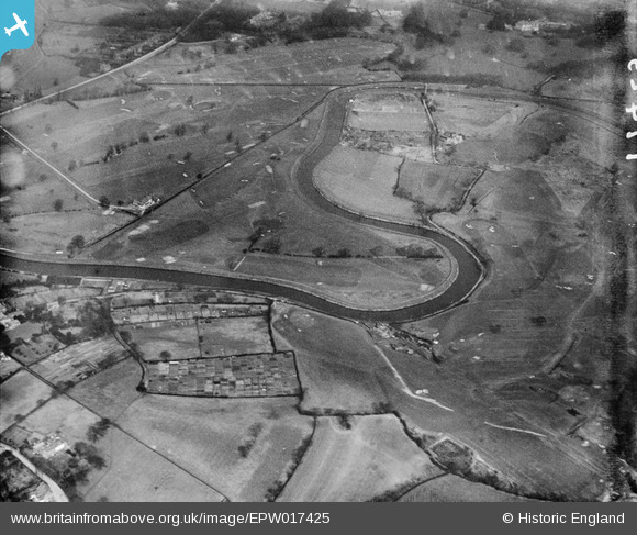
EPW017425 ENGLAND (1927). The Withington and Didsbury Golf Courses, West Didsbury, 1927
© Hawlfraint cyfranwyr OpenStreetMap a thrwyddedwyd gan yr OpenStreetMap Foundation. 2026. Trwyddedir y gartograffeg fel CC BY-SA.
Delweddau cyfagos (2)
EPW017425

EPW041651

Manylion
| Pennawd | [EPW017425] The Withington and Didsbury Golf Courses, West Didsbury, 1927 |
| Cyfeirnod | EPW017425 |
| Dyddiad | 8-March-1927 |
| Dolen | |
| Enw lle | WEST DIDSBURY |
| Plwyf | |
| Ardal | |
| Gwlad | ENGLAND |
| Dwyreiniad / Gogleddiad | 383646, 390161 |
| Hydred / Lledred | -2.2460360098382, 53.407750513582 |
| Cyfeirnod Grid Cenedlaethol | SJ836902 |
Pinnau

John Ellis |
Monday 9th of July 2012 11:19:34 PM | |
|
John Ellis |
Monday 9th of July 2012 11:17:59 PM | |
|
John Ellis |
Monday 9th of July 2012 11:16:38 PM | |
|
John Ellis |
Monday 9th of July 2012 11:15:37 PM | |
|
John Ellis |
Monday 9th of July 2012 11:14:16 PM | |
|
John Ellis |
Monday 9th of July 2012 11:12:53 PM | |
|
John Ellis |
Monday 9th of July 2012 11:10:41 PM | |
|
John Ellis |
Monday 9th of July 2012 11:06:14 PM | |
|
John Ellis |
Monday 9th of July 2012 11:02:39 PM | |
|
John Ellis |
Monday 9th of July 2012 11:01:41 PM | |
|
John Ellis |
Monday 9th of July 2012 11:00:37 PM | |
|
John Ellis |
Monday 9th of July 2012 10:58:50 PM | |
|
John Ellis |
Monday 9th of July 2012 10:57:50 PM | |
|
John Ellis |
Monday 9th of July 2012 10:56:57 PM |