
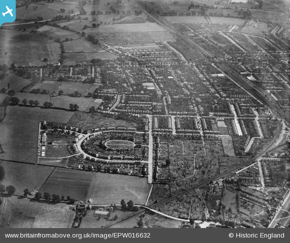
EPW016632 ENGLAND (1926). The Crescent and Mount Pleasant Road, New Malden, 1926
© Hawlfraint cyfranwyr OpenStreetMap a thrwyddedwyd gan yr OpenStreetMap Foundation. 2026. Trwyddedir y gartograffeg fel CC BY-SA.
Delweddau cyfagos (4)
EPW016632

EPW017153

EPW016628

EPW017158

Manylion
| Pennawd | [EPW016632] The Crescent and Mount Pleasant Road, New Malden, 1926 |
| Cyfeirnod | EPW016632 |
| Dyddiad | August-1926 |
| Dolen | |
| Enw lle | NEW MALDEN |
| Plwyf | |
| Ardal | |
| Gwlad | ENGLAND |
| Dwyreiniad / Gogleddiad | 520749, 168911 |
| Hydred / Lledred | -0.26376908878973, 51.405859957604 |
| Cyfeirnod Grid Cenedlaethol | TQ207689 |
