
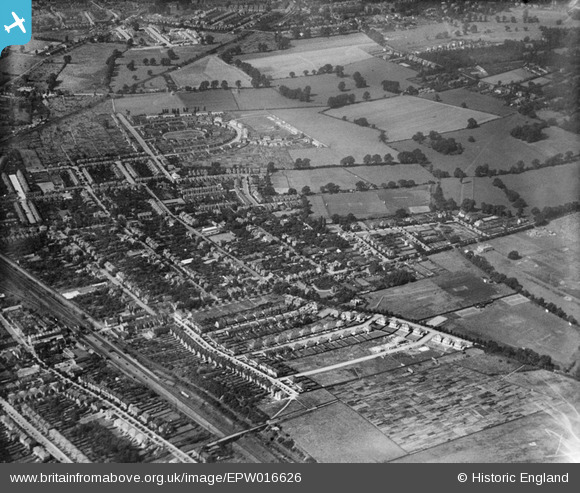
EPW016626 ENGLAND (1926). Lime Grove and environs, New Malden, 1926
© Hawlfraint cyfranwyr OpenStreetMap a thrwyddedwyd gan yr OpenStreetMap Foundation. 2026. Trwyddedir y gartograffeg fel CC BY-SA.
Delweddau cyfagos (2)
EPW016626

EPW016628

Manylion
| Pennawd | [EPW016626] Lime Grove and environs, New Malden, 1926 |
| Cyfeirnod | EPW016626 |
| Dyddiad | August-1926 |
| Dolen | |
| Enw lle | NEW MALDEN |
| Plwyf | |
| Ardal | |
| Gwlad | ENGLAND |
| Dwyreiniad / Gogleddiad | 521004, 169003 |
| Hydred / Lledred | -0.26007290668109, 51.406632539603 |
| Cyfeirnod Grid Cenedlaethol | TQ210690 |
Pinnau

@JohnSouthsea |
Thursday 20th of February 2014 01:57:03 PM | |
|
@JohnSouthsea |
Thursday 20th of February 2014 01:56:26 PM | |
|
@JohnSouthsea |
Thursday 20th of February 2014 01:55:16 PM | |
|
@JohnSouthsea |
Thursday 20th of February 2014 01:53:28 PM | |
|
@JohnSouthsea |
Thursday 20th of February 2014 01:52:42 PM | |
|
@JohnSouthsea |
Thursday 20th of February 2014 01:51:39 PM | |
|
@JohnSouthsea |
Thursday 20th of February 2014 01:51:05 PM |