
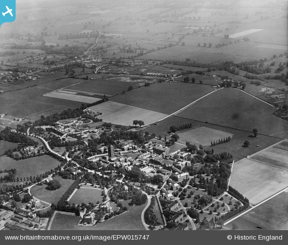
EPW015747 ENGLAND (1926). The Middlesex County Mental Hospital, Napsbury, from the north-west, 1926
© Hawlfraint cyfranwyr OpenStreetMap a thrwyddedwyd gan yr OpenStreetMap Foundation. 2026. Trwyddedir y gartograffeg fel CC BY-SA.
Delweddau cyfagos (6)
EPW015747

EPW024299

EPW025392

EPW025391

EPW015790

EPW015748

Manylion
| Pennawd | [EPW015747] The Middlesex County Mental Hospital, Napsbury, from the north-west, 1926 |
| Cyfeirnod | EPW015747 |
| Dyddiad | 7-June-1926 |
| Dolen | |
| Enw lle | NAPSBURY |
| Plwyf | LONDON COLNEY |
| Ardal | |
| Gwlad | ENGLAND |
| Dwyreiniad / Gogleddiad | 516769, 203829 |
| Hydred / Lledred | -0.30936737698551, 51.720554624625 |
| Cyfeirnod Grid Cenedlaethol | TL168038 |
Pinnau

John W |
Monday 13th of June 2016 05:02:59 PM | |
|
John W |
Monday 13th of June 2016 05:01:01 PM | |
|
John W |
Monday 13th of June 2016 05:00:00 PM | |
|
John W |
Monday 13th of June 2016 04:59:07 PM | |
|
John W |
Monday 13th of June 2016 04:57:53 PM | |
|
John W |
Monday 13th of June 2016 04:57:01 PM | |
|
John W |
Monday 13th of June 2016 04:56:15 PM | |
|
John W |
Monday 13th of June 2016 04:54:43 PM | |
|
John W |
Monday 13th of June 2016 04:53:56 PM |