
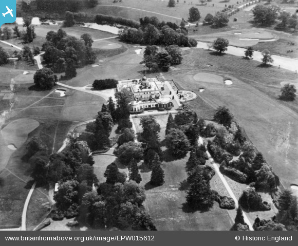
EPW015612 ENGLAND (1926). Stoke Park House and Stoke Poges Golf Course, Stoke Poges, 1926. This image has been produced from a copy-negative.
© Hawlfraint cyfranwyr OpenStreetMap a thrwyddedwyd gan yr OpenStreetMap Foundation. 2026. Trwyddedir y gartograffeg fel CC BY-SA.
Delweddau cyfagos (13)
EPW015612

EPW034745

EPW034744

EPW015611

EPW000032

EPW000033

EPW034746

EPW034740

EPW034737

EPW034735

EPW034738

EPW034741

EPW034736

Manylion
| Pennawd | [EPW015612] Stoke Park House and Stoke Poges Golf Course, Stoke Poges, 1926. This image has been produced from a copy-negative. |
| Cyfeirnod | EPW015612 |
| Dyddiad | 27-May-1926 |
| Dolen | |
| Enw lle | STOKE POGES |
| Plwyf | STOKE POGES |
| Ardal | |
| Gwlad | ENGLAND |
| Dwyreiniad / Gogleddiad | 496961, 182653 |
| Hydred / Lledred | -0.60191905330515, 51.533966044717 |
| Cyfeirnod Grid Cenedlaethol | SU970827 |
Pinnau
Byddwch y cyntaf i ychwanegu sylw at y ddelwedd hon!