
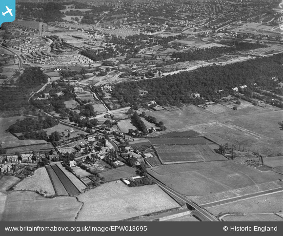
EPW013695 ENGLAND (1925). The village and Bidston Hill, Bidston, from the north-west, 1925
© Hawlfraint cyfranwyr OpenStreetMap a thrwyddedwyd gan yr OpenStreetMap Foundation. 2026. Trwyddedir y gartograffeg fel CC BY-SA.
Delweddau cyfagos (4)
EPW013695

EPW013698

EPW013694

EPW013696

Manylion
| Pennawd | [EPW013695] The village and Bidston Hill, Bidston, from the north-west, 1925 |
| Cyfeirnod | EPW013695 |
| Dyddiad | 12-July-1925 |
| Dolen | |
| Enw lle | BIDSTON |
| Plwyf | |
| Ardal | |
| Gwlad | ENGLAND |
| Dwyreiniad / Gogleddiad | 328227, 390282 |
| Hydred / Lledred | -3.0797090890905, 53.404210586647 |
| Cyfeirnod Grid Cenedlaethol | SJ282903 |
Pinnau

Philip Barton |
Monday 17th of February 2025 08:08:46 PM | |
|
Philip Barton |
Wednesday 12th of February 2025 09:46:34 PM | |
|
Philip Barton |
Wednesday 12th of February 2025 09:43:59 PM | |
|
Philip Barton |
Wednesday 12th of February 2025 09:43:31 PM | |
|
Philip Barton |
Wednesday 12th of February 2025 09:42:09 PM | |
|
Philip Barton |
Wednesday 12th of February 2025 09:41:16 PM | |
|
BobH |
Friday 9th of April 2021 01:29:33 PM | |
|
BobH |
Friday 9th of April 2021 01:27:23 PM | |
|
BobH |
Friday 9th of April 2021 01:26:11 PM | |
|
JohnH |
Wednesday 20th of May 2020 11:23:38 PM | |
|
BobH |
Thursday 7th of July 2016 05:48:48 PM | |
|
Skafloc |
Friday 5th of June 2015 09:55:55 PM | |
|
hughes di |
Tuesday 21st of January 2014 06:59:09 PM | |
|
kinmel |
Saturday 21st of December 2013 10:24:17 PM | |
|
kinmel |
Saturday 21st of December 2013 10:08:56 PM | |
|
kinmel |
Saturday 21st of December 2013 10:06:48 PM | |
|
RingoDave |
Sunday 1st of December 2013 05:14:10 AM | |
Sorry this is the bridge over what would be the railway line. |
RingoDave |
Sunday 1st of December 2013 05:15:26 AM |
|
BruceR |
Friday 14th of December 2012 10:10:26 PM | |
|
BruceR |
Friday 14th of December 2012 10:08:09 PM | |
|
debs |
Wednesday 21st of November 2012 10:59:25 PM |