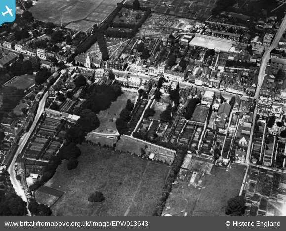
EPW013643 ENGLAND (1925). The High Street, Lymington, 1925. This image has been produced from a print.
    © Hawlfraint cyfranwyr OpenStreetMap a thrwyddedwyd gan yr OpenStreetMap Foundation. 2025. Trwyddedir y gartograffeg fel CC BY-SA.
  
Delweddau cyfagos (6)
Manylion
| Pennawd | [EPW013643] The High Street, Lymington, 1925. This image has been produced from a print. | 
| Cyfeirnod | EPW013643 | 
| Dyddiad | July-1925 | 
| Dolen | |
| Enw lle | LYMINGTON | 
| Plwyf | LYMINGTON AND PENNINGTON | 
| Ardal | |
| Gwlad | ENGLAND | 
| Dwyreiniad / Gogleddiad | 432312, 95412 | 
| Hydred / Lledred | -1.5418610937804, 50.756833865916 | 
| Cyfeirnod Grid Cenedlaethol | SZ323954 | 
Pinnau
Byddwch y cyntaf i ychwanegu sylw at y ddelwedd hon!
 
             
  ![[EPW013643] The High Street, Lymington, 1925. This image has been produced from a print.](http://britainfromabove.org.uk/sites/all/libraries/aerofilms-images/public/100x100/EPW/013/EPW013643.jpg) 
  
                                          ![[EAW043399] The town centre, Lymington, 1952](http://britainfromabove.org.uk/sites/all/libraries/aerofilms-images/public/100x100/EAW/043/EAW043399.jpg) 
 ![[EAW018163] The High Street and environs, Lymington, from the west, 1948. This image has been produced from a print.](http://britainfromabove.org.uk/sites/all/libraries/aerofilms-images/public/100x100/EAW/018/EAW018163.jpg) 
 ![[EPW022941] The High Street, Lymington, 1928](http://britainfromabove.org.uk/sites/all/libraries/aerofilms-images/public/100x100/EPW/022/EPW022941.jpg) 
 ![[EPW022934] St Thomas's Street and environs, Lymington, 1928](http://britainfromabove.org.uk/sites/all/libraries/aerofilms-images/public/100x100/EPW/022/EPW022934.jpg) 
 ![[EAW018162] The town, Lymington, from the north-west, 1948. This image has been produced from a print.](http://britainfromabove.org.uk/sites/all/libraries/aerofilms-images/public/100x100/EAW/018/EAW018162.jpg)