
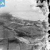
EPW006531 ENGLAND (1921). The Docks and the River Humber, Immingham Dock, from the south, 1921

© Hawlfraint cyfranwyr OpenStreetMap a thrwyddedwyd gan yr OpenStreetMap Foundation. 2026. Trwyddedir y gartograffeg fel CC BY-SA.
Delweddau cyfagos (3)
EPW006531
 0°
0m
0°
0m
EAW029098
 235°
86m
235°
86m
EAW029092
 63°
265m
63°
265m
Manylion
| Pennawd | [EPW006531] The Docks and the River Humber, Immingham Dock, from the south, 1921 |
| Cyfeirnod | EPW006531 |
| Dyddiad | June-1921 |
| Dolen | |
| Enw lle | IMMINGHAM DOCK |
| Plwyf | IMMINGHAM |
| Ardal | |
| Gwlad | ENGLAND |
| Dwyreiniad / Gogleddiad | 519972, 414996 |
| Hydred / Lledred | -0.18607115100728, 53.617510679778 |
| Cyfeirnod Grid Cenedlaethol | TA200150 |
Pinnau
 North Killingholme Haven North Killingholme Haven |

DaveH |
Monday 5th of October 2020 02:09:12 PM |
| Brickworks |
DaveH |
Monday 5th of October 2020 02:05:35 PM |
| The railway line from Immingham Dock to Goxhill. |
DaveH |
Monday 5th of October 2020 01:51:48 PM |
| Queens Road. The electric tramway was laid along this road but was never used by fare paying passengers. The Masts carrying the tramway's overhead wires can be seen running along both sides of the road. |
DaveH |
Monday 5th of October 2020 01:50:16 PM |
| Power station. This supplied power for the dock and the Grimsby and Immingham Electric Railway (tramway). |
DaveH |
Monday 5th of October 2020 01:47:35 PM |
| Eastern Jetty |
DaveH |
Monday 5th of October 2020 01:45:46 PM |
| Coal hoist for loading export coal into the holds of ships. Each hoist had two railway lines, one at ground level, the other some feet in the air at the end of an embankment. Wagons were delivered to the bottom of the hoists by gravity, lifted to the necessary height by the hoist, tipped to discharge the coal into the ship's hold then passed to the hoist's higher level line, where they rolled away to the marshalling area, also by gravity. |
DaveH |
Monday 5th of October 2020 01:44:52 PM |
| Western Jetty |
DaveH |
Monday 5th of October 2020 01:39:24 PM |
| Immingham Engine Shed, referred to by railwaymen as "Loco". In BR days it was numbered 40B |
DaveH |
Monday 5th of October 2020 01:38:54 PM |
| Dormitory block for visiting crew on lodging turns. |
DaveH |
Monday 9th of May 2016 11:03:43 PM |
Cyfraniadau Grŵp
Queens road snaking through the photograph. The terraces shown are still standing, but with only a couple of exceptions (Those to the extreme left of this picture), they are now all shipping offices / take aways etc. There is even a massage parlour in there now too! The surrounding fields are all now of induistrial use, with factories, offices, and the council landfill site now to the right of this picture. |
Andy Donkin |
Tuesday 26th of June 2012 04:51:43 PM |