
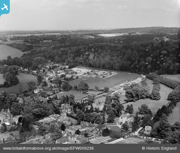
EPW006238 ENGLAND (1921). View of the village, Mickleham, from the west, 1921
© Hawlfraint cyfranwyr OpenStreetMap a thrwyddedwyd gan yr OpenStreetMap Foundation. 2025. Trwyddedir y gartograffeg fel CC BY-SA.
Delweddau cyfagos (2)
EPW006238

EPW001638

Manylion
| Pennawd | [EPW006238] View of the village, Mickleham, from the west, 1921 |
| Cyfeirnod | EPW006238 |
| Dyddiad | 23-May-1921 |
| Dolen | |
| Enw lle | MICKLEHAM |
| Plwyf | MICKLEHAM |
| Ardal | |
| Gwlad | ENGLAND |
| Dwyreiniad / Gogleddiad | 517139, 153527 |
| Hydred / Lledred | -0.3207138332384, 51.268332319675 |
| Cyfeirnod Grid Cenedlaethol | TQ171535 |
Pinnau

Benicek |
Saturday 30th of March 2013 11:53:10 AM | |
|
Benicek |
Saturday 30th of March 2013 11:51:49 AM | |

Class31 |
Tuesday 30th of October 2012 05:44:20 PM | |
|
rog8811 |
Wednesday 5th of September 2012 08:38:13 PM | |
There was no building in 1920 where Frascati restaurant is now: see Byttom Hill image |
Reginald |
Friday 29th of March 2013 04:49:25 PM |
