
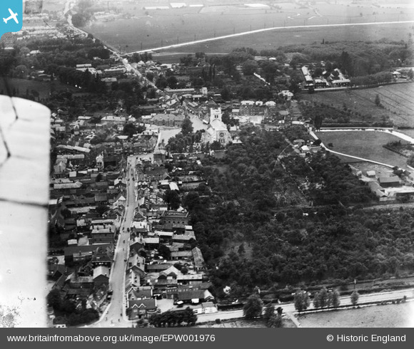
EPW001976 ENGLAND (1920). The Church of the Holy Cross and St Lawrence and Abbey Gardens, Waltham Abbey, 1920
© Hawlfraint cyfranwyr OpenStreetMap a thrwyddedwyd gan yr OpenStreetMap Foundation. 2026. Trwyddedir y gartograffeg fel CC BY-SA.
Delweddau cyfagos (10)
EPW001976

EPW001808

EPW001809

EAW008208

EAW008206

EPW013334

EAW008207

EPW001806

EPW013335

EPW001975

Manylion
| Pennawd | [EPW001976] The Church of the Holy Cross and St Lawrence and Abbey Gardens, Waltham Abbey, 1920 |
| Cyfeirnod | EPW001976 |
| Dyddiad | June-1920 |
| Dolen | |
| Enw lle | WALTHAM ABBEY |
| Plwyf | WALTHAM ABBEY |
| Ardal | |
| Gwlad | ENGLAND |
| Dwyreiniad / Gogleddiad | 538189, 200631 |
| Hydred / Lledred | -0.00069480930615678, 51.686945655127 |
| Cyfeirnod Grid Cenedlaethol | TL382006 |
Pinnau

Mark |
Monday 9th of March 2026 10:14:46 PM | |
|
Ray Flack |
Sunday 29th of June 2014 01:10:59 PM | |
|
Ray Flack |
Sunday 29th of June 2014 12:09:49 PM | |
|
Ray Flack |
Sunday 29th of June 2014 12:08:06 PM | |
|
Ray Flack |
Sunday 29th of June 2014 12:07:13 PM | |
|
Ray Flack |
Sunday 29th of June 2014 12:00:17 PM | |
|
Ray Flack |
Sunday 29th of June 2014 11:56:58 AM | |
|
Ray Flack |
Sunday 29th of June 2014 11:56:06 AM | |
|
Ray Flack |
Sunday 29th of June 2014 11:54:52 AM | |
|
Ray Flack |
Sunday 29th of June 2014 11:54:11 AM | |
|
Ray Flack |
Sunday 29th of June 2014 11:53:26 AM | |
|
Ray Flack |
Sunday 29th of June 2014 11:52:26 AM | |

somoody |
Friday 3rd of May 2013 11:50:03 PM |