
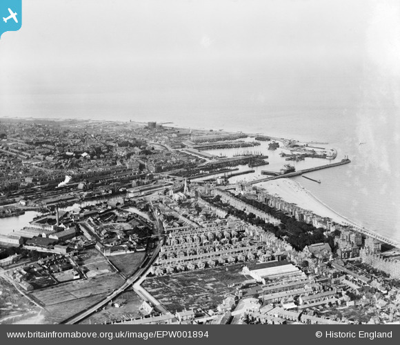
EPW001894 ENGLAND (1920). View of Lowestoft Harbour, Lowestoft, from the south-west, 1920
© Hawlfraint cyfranwyr OpenStreetMap a thrwyddedwyd gan yr OpenStreetMap Foundation. 2026. Trwyddedir y gartograffeg fel CC BY-SA.
Delweddau cyfagos (2)
EPW001894

EPW021243

Manylion
| Pennawd | [EPW001894] View of Lowestoft Harbour, Lowestoft, from the south-west, 1920 |
| Cyfeirnod | EPW001894 |
| Dyddiad | June-1920 |
| Dolen | |
| Enw lle | LOWESTOFT |
| Plwyf | |
| Ardal | |
| Gwlad | ENGLAND |
| Dwyreiniad / Gogleddiad | 654432, 292339 |
| Hydred / Lledred | 1.7465239521636, 52.469209237201 |
| Cyfeirnod Grid Cenedlaethol | TM544923 |
Pinnau

Eddy |
Thursday 20th of August 2020 01:08:18 PM | |
|
Eddy |
Wednesday 19th of August 2020 01:34:27 PM | |
|
Eddy |
Wednesday 19th of August 2020 01:31:20 PM | |
|
Eddy |
Wednesday 19th of August 2020 01:29:45 PM | |
|
Eddy |
Wednesday 19th of August 2020 01:28:42 PM | |
|
Eddy |
Wednesday 19th of August 2020 01:27:19 PM | |
|
Eddy |
Wednesday 19th of August 2020 01:20:54 PM | |
|
Brightonboy |
Wednesday 17th of June 2020 09:48:14 PM | |
|
Brightonboy |
Wednesday 17th of June 2020 09:44:58 PM | |
|
Brightonboy |
Saturday 4th of January 2014 10:08:42 PM | |
|
Brightonboy |
Saturday 4th of January 2014 10:07:38 PM | |
|
Brightonboy |
Saturday 4th of January 2014 10:07:06 PM | |

Class31 |
Thursday 20th of June 2013 02:09:39 PM | |
|
Brightonboy |
Tuesday 16th of April 2013 08:37:59 PM | |
|
Brightonboy |
Tuesday 16th of April 2013 08:35:44 PM |
