
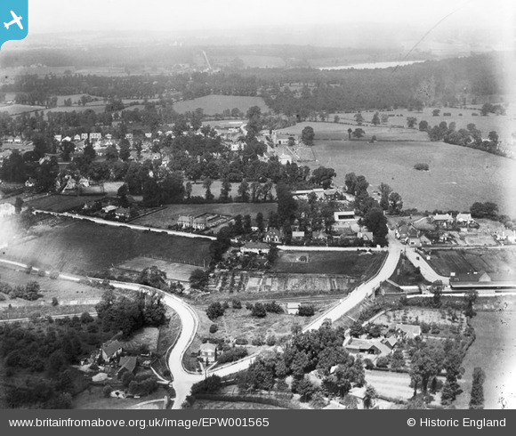
EPW001565 ENGLAND (1920). West End Road and environs, Ruislip, from the south, 1920
© Hawlfraint cyfranwyr OpenStreetMap a thrwyddedwyd gan yr OpenStreetMap Foundation. 2026. Trwyddedir y gartograffeg fel CC BY-SA.
Delweddau cyfagos (4)
EPW001565

EPW044503

EPW044189

EPW044517

Manylion
| Pennawd | [EPW001565] West End Road and environs, Ruislip, from the south, 1920 |
| Cyfeirnod | EPW001565 |
| Dyddiad | June-1920 |
| Dolen | |
| Enw lle | RUISLIP |
| Plwyf | |
| Ardal | |
| Gwlad | ENGLAND |
| Dwyreiniad / Gogleddiad | 509348, 186985 |
| Hydred / Lledred | -0.42203250844066, 51.570642715944 |
| Cyfeirnod Grid Cenedlaethol | TQ093870 |
Pinnau

Des Elmes |
Sunday 10th of April 2016 10:12:42 PM | |
|
Des Elmes |
Sunday 10th of April 2016 10:12:07 PM | |

class 86/87 |
Monday 29th of February 2016 08:30:22 PM | |
|
myraroy |
Wednesday 27th of June 2012 11:38:29 AM | |
|
myraroy |
Wednesday 27th of June 2012 11:37:36 AM | |
|
myraroy |
Wednesday 27th of June 2012 11:36:09 AM | |
|
Dai |
Wednesday 27th of June 2012 07:55:16 AM | |
|
Dai |
Wednesday 27th of June 2012 07:54:13 AM | |
|
Dai |
Wednesday 27th of June 2012 07:53:36 AM |