
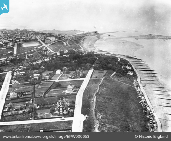
EPW000653 ENGLAND (1920). Marine Parade, The Paddock (Mussel Bed) and environs, Whitstable, from the east, 1920. This image has been produced from a print.
© Hawlfraint cyfranwyr OpenStreetMap a thrwyddedwyd gan yr OpenStreetMap Foundation. 2026. Trwyddedir y gartograffeg fel CC BY-SA.
Delweddau cyfagos (12)
EPW000653
 and environs, Whitstable, from the east, 1920. This image has been produced from a print.")
EPW018622

EPW018621

EPW009155

EAW042697

EAW042695

EAW042699

EAW042692

EPW035503

EAW042693

EAW042691

EAW042698

Manylion
| Pennawd | [EPW000653] Marine Parade, The Paddock (Mussel Bed) and environs, Whitstable, from the east, 1920. This image has been produced from a print. |
| Cyfeirnod | EPW000653 |
| Dyddiad | May-1920 |
| Dolen | |
| Enw lle | WHITSTABLE |
| Plwyf | |
| Ardal | |
| Gwlad | ENGLAND |
| Dwyreiniad / Gogleddiad | 611563, 167218 |
| Hydred / Lledred | 1.039471708364, 51.364061223942 |
| Cyfeirnod Grid Cenedlaethol | TR116672 |
Pinnau

Sparky |
Sunday 13th of August 2017 01:01:15 PM |