
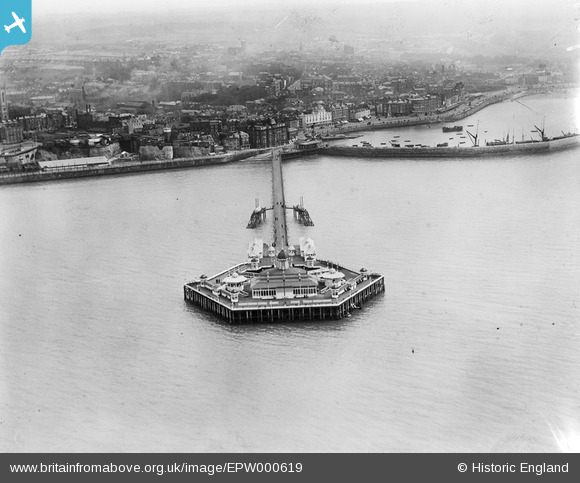
EPW000619 ENGLAND (1920). The Jetty, Margate, 1920
© Hawlfraint cyfranwyr OpenStreetMap a thrwyddedwyd gan yr OpenStreetMap Foundation. 2026. Trwyddedir y gartograffeg fel CC BY-SA.
Delweddau cyfagos (13)
EPW000619

EPW035467

EPW018601

EAW015840

EPW009163

EPW000627

EPW048849

EPW048851

EPW000631

EPW009240

EPW000634

EAW015841

EPW048847

Manylion
| Pennawd | [EPW000619] The Jetty, Margate, 1920 |
| Cyfeirnod | EPW000619 |
| Dyddiad | April-1920 |
| Dolen | |
| Enw lle | MARGATE |
| Plwyf | |
| Ardal | |
| Gwlad | ENGLAND |
| Dwyreiniad / Gogleddiad | 635285, 171471 |
| Hydred / Lledred | 1.3824905466757, 51.392911507273 |
| Cyfeirnod Grid Cenedlaethol | TR353715 |
Pinnau

Kentishman |
Monday 20th of November 2023 07:15:17 AM |
Cyfraniadau Grŵp
One more thing that made Margate lost forever to the storm of 1978 |
Djtnegra |
Tuesday 26th of June 2012 07:38:11 AM |