
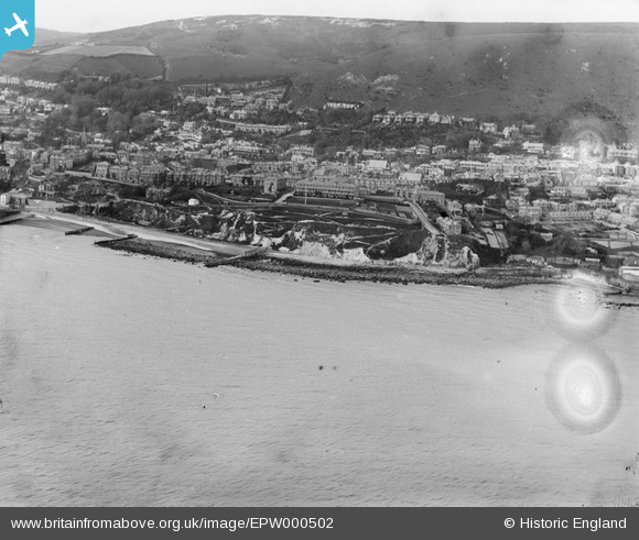
EPW000502 ENGLAND (1920). Ventnor, Isle of Wight, from the south-east, 1920
© Hawlfraint cyfranwyr OpenStreetMap a thrwyddedwyd gan yr OpenStreetMap Foundation. 2026. Trwyddedir y gartograffeg fel CC BY-SA.
Delweddau cyfagos (4)
EPW000502

EPW032287

EPW000505

EAW038593

Manylion
| Pennawd | [EPW000502] Ventnor, Isle of Wight, from the south-east, 1920 |
| Cyfeirnod | EPW000502 |
| Dyddiad | April-1920 |
| Dolen | |
| Enw lle | VENTNOR |
| Plwyf | VENTNOR |
| Ardal | |
| Gwlad | ENGLAND |
| Dwyreiniad / Gogleddiad | 456645, 77259 |
| Hydred / Lledred | -1.1996625380704, 50.591720349304 |
| Cyfeirnod Grid Cenedlaethol | SZ566773 |
Pinnau
Byddwch y cyntaf i ychwanegu sylw at y ddelwedd hon!