
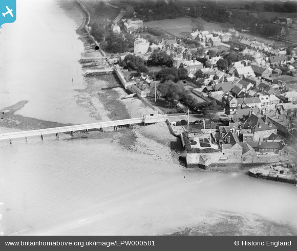
EPW000501 ENGLAND (1920). Yarmouth Pier, Yarmouth, Isle of Wight, 1920
© Hawlfraint cyfranwyr OpenStreetMap a thrwyddedwyd gan yr OpenStreetMap Foundation. 2026. Trwyddedir y gartograffeg fel CC BY-SA.
Delweddau cyfagos (6)
EPW000501

EPW022971

EPW022974

EPW022972

EPW022973

EPW022975

Manylion
| Pennawd | [EPW000501] Yarmouth Pier, Yarmouth, Isle of Wight, 1920 |
| Cyfeirnod | EPW000501 |
| Dyddiad | April-1920 |
| Dolen | |
| Enw lle | YARMOUTH |
| Plwyf | YARMOUTH |
| Ardal | |
| Gwlad | ENGLAND |
| Dwyreiniad / Gogleddiad | 435444, 89811 |
| Hydred / Lledred | -1.4979941333423, 50.706279250758 |
| Cyfeirnod Grid Cenedlaethol | SZ354898 |
