
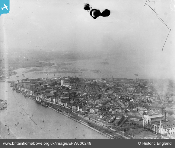
EPW000248 ENGLAND (1920). Poole and Poole Bay, from the south-east, 1920
© Hawlfraint cyfranwyr OpenStreetMap a thrwyddedwyd gan yr OpenStreetMap Foundation. 2026. Trwyddedir y gartograffeg fel CC BY-SA.
Delweddau cyfagos (2)
EPW000248

EPW013629

Manylion
| Pennawd | [EPW000248] Poole and Poole Bay, from the south-east, 1920 |
| Cyfeirnod | EPW000248 |
| Dyddiad | April-1920 |
| Dolen | |
| Enw lle | POOLE |
| Plwyf | |
| Ardal | |
| Gwlad | ENGLAND |
| Dwyreiniad / Gogleddiad | 401053, 90740 |
| Hydred / Lledred | -1.9850830333717, 50.715714236229 |
| Cyfeirnod Grid Cenedlaethol | SZ011907 |
Pinnau

Class31 |
Saturday 22nd of June 2013 03:59:02 PM | |

micky |
Friday 4th of January 2013 01:51:17 PM | |
|
micky |
Friday 4th of January 2013 01:49:15 PM | |
|
micky |
Friday 4th of January 2013 01:48:24 PM | |
|
micky |
Friday 4th of January 2013 01:47:54 PM | |
|
KeithFP |
Thursday 8th of November 2012 12:51:12 PM | |
|
KeithFP |
Thursday 8th of November 2012 12:49:32 PM | |
|
KeithFP |
Thursday 8th of November 2012 12:46:20 PM | |
|
KeithFP |
Thursday 8th of November 2012 12:44:26 PM | |
|
KeithFP |
Thursday 8th of November 2012 12:43:13 PM | |
|
Class31 |
Tuesday 25th of September 2012 01:44:04 PM |

Cyfraniadau Grŵp
I can see two of my favourite pubs. The Jolly Sailor and the Lord Nelson. |
Marco |
Wednesday 27th of June 2012 01:20:15 PM |