
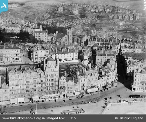
EPW000115 ENGLAND (1920). White Rock, Hastings, 1920
© Hawlfraint cyfranwyr OpenStreetMap a thrwyddedwyd gan yr OpenStreetMap Foundation. 2026. Trwyddedir y gartograffeg fel CC BY-SA.
Delweddau cyfagos (20)
EPW000115

EPW042839

EPW000754

EPW026192

EPW039370

EPW044645

EPW039366

EPW039369

EPW016891

EPW044646

EPW044647

EPW044644

EPW044648

EPW035339

EAW002406

EPW026209

EPW026200

EAW022975

EPW039388

EPW035334

Manylion
| Pennawd | [EPW000115] White Rock, Hastings, 1920 |
| Cyfeirnod | EPW000115 |
| Dyddiad | February-1920 |
| Dolen | |
| Enw lle | HASTINGS |
| Plwyf | |
| Ardal | |
| Gwlad | ENGLAND |
| Dwyreiniad / Gogleddiad | 581385, 109305 |
| Hydred / Lledred | 0.5773074527543, 50.854218150126 |
| Cyfeirnod Grid Cenedlaethol | TQ814093 |
Pinnau

Jim |
Thursday 24th of July 2014 08:34:39 PM |
Cyfraniadau Grŵp
Not "The White Rock" (the original site of the White Rock was further west). This is White Rock Parade. |
Jim |
Thursday 24th of July 2014 08:33:20 PM |
Love this photo . I can see Saint Michaels Place in the middle of the photo , where my Dad grew up & to the right Cambridge Road where i lived till i was about 11 . |

Erica |
Saturday 30th of June 2012 07:52:16 PM |