
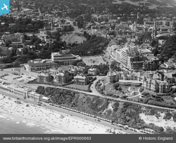
EPR000663 ENGLAND (1935). The Royal Bath Hotel, Pavilion and the town centre, Bournemouth, 1935
© Hawlfraint cyfranwyr OpenStreetMap a thrwyddedwyd gan yr OpenStreetMap Foundation. 2026. Trwyddedir y gartograffeg fel CC BY-SA.
Delweddau cyfagos (19)
EPR000663

EPW041045

EPW013563

EPW037423

EPW013552

EAW002994

EPW000266

EAW049057

EPR000286

EAW018154

EPW013553

EPW013560

EAW034624

EAW035603

EAW002993

EAW034625

EPW061510

EPR000282

EPW018167

Manylion
| Pennawd | [EPR000663] The Royal Bath Hotel, Pavilion and the town centre, Bournemouth, 1935 |
| Cyfeirnod | EPR000663 |
| Dyddiad | 26-June-1935 |
| Dolen | |
| Enw lle | BOURNEMOUTH |
| Plwyf | |
| Ardal | |
| Gwlad | ENGLAND |
| Dwyreiniad / Gogleddiad | 408981, 90925 |
| Hydred / Lledred | -1.8727693762892, 50.717309611271 |
| Cyfeirnod Grid Cenedlaethol | SZ090909 |
Pinnau

Class31 |
Saturday 17th of October 2015 11:34:54 PM |
