
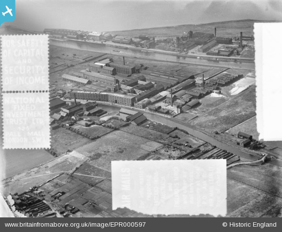
EPR000597 ENGLAND (1935). The Highfield Tannery and environs, Runcorn, 1935. This image was marked by Aero Pictorial Ltd for photo editing.
© Hawlfraint cyfranwyr OpenStreetMap a thrwyddedwyd gan yr OpenStreetMap Foundation. 2026. Trwyddedir y gartograffeg fel CC BY-SA.
Delweddau cyfagos (7)
EPR000597

EPR000596

EPR000595

EPR000512A

EPR000513

EPR000598

EPR000594

Manylion
| Pennawd | [EPR000597] The Highfield Tannery and environs, Runcorn, 1935. This image was marked by Aero Pictorial Ltd for photo editing. |
| Cyfeirnod | EPR000597 |
| Dyddiad | 10-May-1935 |
| Dolen | |
| Enw lle | RUNCORN |
| Plwyf | |
| Ardal | |
| Gwlad | ENGLAND |
| Dwyreiniad / Gogleddiad | 352736, 382979 |
| Hydred / Lledred | -2.7099573702372, 53.341328500199 |
| Cyfeirnod Grid Cenedlaethol | SJ527830 |
Pinnau

Bottom Yard |
Wednesday 26th of December 2018 11:56:44 PM | |
|
Bottom Yard |
Wednesday 26th of December 2018 11:53:09 PM | |
|
Bottom Yard |
Wednesday 26th of December 2018 11:51:10 PM | |
|
Bottom Yard |
Wednesday 26th of December 2018 11:48:54 PM | |
|
Bottom Yard |
Wednesday 26th of December 2018 11:46:58 PM |