
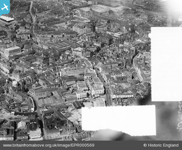
EPR000569 ENGLAND (1935). Victoria Street and the town centre, Wolverhampton, 1935. This image was marked by Aero Pictorial Ltd for photo editing.
© Hawlfraint cyfranwyr OpenStreetMap a thrwyddedwyd gan yr OpenStreetMap Foundation. 2026. Trwyddedir y gartograffeg fel CC BY-SA.
Delweddau cyfagos (15)
EPR000569

EPW053730

EPW057479

EPW057473

EPW011835

EPW053724

EPW057476

EPW057472

EPR000556

EPW011832

EPW022595

EPW053729

EPW053728

EAW017630

EPW053731

Manylion
| Pennawd | [EPR000569] Victoria Street and the town centre, Wolverhampton, 1935. This image was marked by Aero Pictorial Ltd for photo editing. |
| Cyfeirnod | EPR000569 |
| Dyddiad | 11-May-1935 |
| Dolen | |
| Enw lle | WOLVERHAMPTON |
| Plwyf | |
| Ardal | |
| Gwlad | ENGLAND |
| Dwyreiniad / Gogleddiad | 391310, 298586 |
| Hydred / Lledred | -2.1282731110701, 52.584654777299 |
| Cyfeirnod Grid Cenedlaethol | SO913986 |
Pinnau

PeterD |
Wednesday 24th of October 2018 12:09:37 AM |