
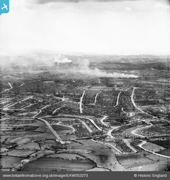
EAW053273 ENGLAND (1954). The residential area of Little Bloxwich looking towards Walsall, Bloxwich, from the north, 1954
© Hawlfraint cyfranwyr OpenStreetMap a thrwyddedwyd gan yr OpenStreetMap Foundation. 2026. Trwyddedir y gartograffeg fel CC BY-SA.
Delweddau cyfagos (2)
EAW053273

EAW053274

Manylion
| Pennawd | [EAW053273] The residential area of Little Bloxwich looking towards Walsall, Bloxwich, from the north, 1954 |
| Cyfeirnod | EAW053273 |
| Dyddiad | 26-March-1954 |
| Dolen | |
| Enw lle | BLOXWICH |
| Plwyf | |
| Ardal | |
| Gwlad | ENGLAND |
| Dwyreiniad / Gogleddiad | 400822, 302835 |
| Hydred / Lledred | -1.9878558783485, 52.622925609754 |
| Cyfeirnod Grid Cenedlaethol | SK008028 |
Pinnau

Jo |
Saturday 4th of June 2022 08:02:03 PM | |
|
Post-war prefabs |
Monday 20th of January 2020 04:18:12 PM | |
|
Post-war prefabs |
Sunday 24th of November 2019 11:04:24 AM | |
|
John Llewellyn |
Thursday 10th of November 2016 03:41:05 PM | |
|
John Llewellyn |
Thursday 10th of November 2016 03:39:58 PM | |
|
John Llewellyn |
Thursday 10th of November 2016 03:38:53 PM | |
|
John Llewellyn |
Thursday 10th of November 2016 03:37:40 PM | |
|
John Llewellyn |
Thursday 10th of November 2016 03:36:40 PM | |
|
John Llewellyn |
Thursday 10th of November 2016 03:35:20 PM | |
|
John Llewellyn |
Thursday 10th of November 2016 03:34:18 PM | |
|
John Llewellyn |
Thursday 10th of November 2016 03:32:26 PM | |
|
John Llewellyn |
Thursday 10th of November 2016 03:31:23 PM | |
|
John Llewellyn |
Thursday 10th of November 2016 03:30:18 PM |