
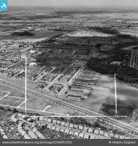
EAW051550 ENGLAND (1953). The Butts Farm Estate and environs, Hanworth, from the east, 1953. This image was marked by Aerofilms Ltd for photo editing.
© Hawlfraint cyfranwyr OpenStreetMap a thrwyddedwyd gan yr OpenStreetMap Foundation. 2026. Trwyddedir y gartograffeg fel CC BY-SA.
Delweddau cyfagos (2)
EAW051550

EAW051551

Manylion
| Pennawd | [EAW051550] The Butts Farm Estate and environs, Hanworth, from the east, 1953. This image was marked by Aerofilms Ltd for photo editing. |
| Cyfeirnod | EAW051550 |
| Dyddiad | 14-August-1953 |
| Dolen | |
| Enw lle | HANWORTH |
| Plwyf | |
| Ardal | |
| Gwlad | ENGLAND |
| Dwyreiniad / Gogleddiad | 513252, 172475 |
| Hydred / Lledred | -0.37037961081824, 51.439443700536 |
| Cyfeirnod Grid Cenedlaethol | TQ133725 |
